How to Use the Norwegian Scenic Routes (All 18 Explained)
Norway has 18 officially designated Scenic Routes — and not all of them are worth the detour. We’ve driven most of them. Here’s the honest guide: which ones to prioritise, how they actually work, and what nobody tells you before you go.
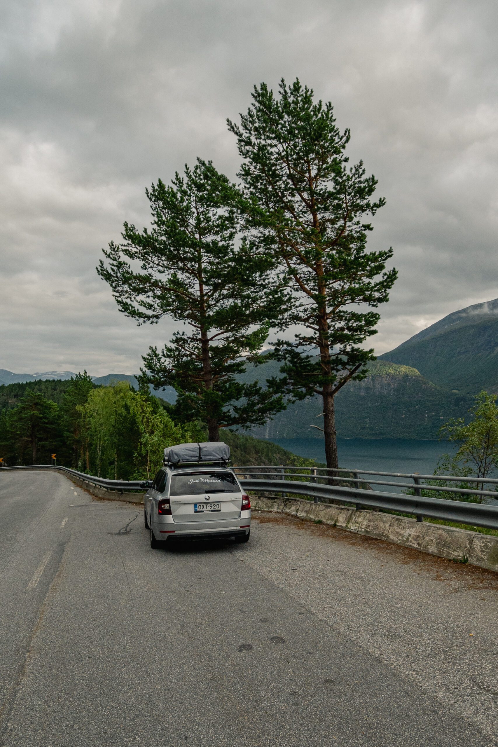
When we planned our first Norway road trip from Rovaniemi, we did what most people do: we looked up “Norwegian Scenic Routes,” downloaded the map, and assumed we’d drive all 18. We did not drive all 18. We didn’t even come close. What we did do was learn — sometimes the hard way — which routes are genuinely unmissable, which ones are impressive on a map but underwhelming in person, and how to use the official system in a way that actually makes your trip better rather than just longer.
Norway’s Nasjonale Turistveger (National Scenic Routes) are 18 specially designated stretches of road chosen for their natural scenery and architectural rest stops. The program has been running since the 1990s and has become one of Norway’s biggest tourism draws. But the routes vary wildly in character, length, and practicality. This guide explains all 18 — and tells you which ones to actually plan your route around.
The Norwegian Scenic Routes are 18 officially designated roads chosen for outstanding natural scenery, each marked with brown signs and equipped with architect-designed rest stops. The best for a summer road trip are Atlanterhavsvegen (Atlantic Ocean Road), Trollstigen, Hardanger, and Sognefjellet — these four alone justify a full week on the road. Use the official Scenic Routes app to navigate and find the pit stops; signal can be unreliable, so download maps offline before you go.
What the Norwegian Scenic Routes actually are
The routes were created by the Norwegian government to draw visitors beyond the main highways and into landscapes that most tourists would otherwise miss. Each route is marked on regular road signs with a brown scenic route symbol, and the stretches are accompanied by a series of tourist facilities — rest stops, viewpoints, toilets, and walkways — designed by some of Norway’s most celebrated architects. These facilities alone are worth seeking out: many are genuinely striking pieces of landscape architecture.
The official system at a glance
The 18 routes span the full length of Norway, from Jæren in the south-west to Varanger in the far north-east, just a few hundred kilometres from the Russian border. Combined, they cover roughly 2,000 kilometres of road. Some routes are short loops you can knock out in 90 minutes; others take a full day. They are not a single connected trail — they are individual stretches scattered across the country, and getting between them requires driving on regular roads.
Who they’re designed for
- Road trippers who want to slow down and take intentional detours rather than racing between cities.
- Photographers — the rest stops are positioned at viewpoints that have been scouted specifically for composition.
- Cyclists — several routes (particularly Hardanger and Gaularfjellet) are popular with cyclists in summer.
- Anyone who wants to feel like they’ve discovered Norway rather than just passing through it. The routes do a genuinely good job of this.
How to navigate and use the route system
The routes are well-signposted once you’re on them, but finding the start points requires a little homework before you leave the car park at the hotel. Here’s how we approach it.
The official app and website
The Norwegian Scenic Routes program has its own app (Nasjonale Turistveger) and website at nasjonaleturistveger.no. Both list every rest stop, viewpoint, and facility along each route with GPS coordinates. The app works offline once you’ve loaded the route data — which is essential, because mobile signal on several routes is either patchy or non-existent.
Brown signs and what they mean
- Brown scenic route sign: you’re on an official Scenic Route stretch.
- White viewpoint symbol on brown background: a designated viewpoint or rest stop ahead. Pull in. It’s worth it.
- Facility icons: toilet, picnic table, parking. These are reliably accurate — the program maintains them well.
- Route start/end markers: blue-and-white signs at each end of the designated stretch. Some routes start from a roundabout; others from a ferry terminal.
Practical driving notes
- Some routes have sections that are closed in winter — Sognefjellet and Gamle Strynefjellsvegen typically open in May. Check the route website for opening dates.
- Sheep and reindeer on the road are real. Drive slower than you think you need to, especially on mountain sections.
- Toll roads: Norway uses an automatic tolling system (AutoPASS). Most foreign rental cars are registered and the toll will appear on your credit card. Check with your rental company before you go.
- Petrol stations are sparse on several routes. Fill up in the nearest town before you start a route — we learned this the hard way on Jæren.
Related read Thinking about driving Trollstigen? See our full guide: How to Drive the Trollstigen Mountain Road: What to Expect
All 18 Norwegian Scenic Routes: quick-reference overview
Here’s what you actually need to know about each route — name, region, rough length, and our honest one-line verdict. We’ve marked our top picks with ★.
The most photographed road in Norway: eight bridges hopping between tiny islands with the Atlantic breaking all around. Drive it in both directions — it looks completely different each way. Opens year-round but best in storm season (autumn) or on a clear summer morning.
Norway’s most visited scenic route, and for good reason. The famous serpentine descent into Romsdalen valley is genuinely dramatic. The National Tourist Route Road Project visitor centre at the top is worth 30 minutes on its own. Can be very busy in July — arrive early.
The longest and arguably most varied route, running along the Hardangerfjord through orchards, waterfalls (Voringsfossen is a detour worth making), and glacier views. Combines well with a night in Ulvik or Eidfjord.
The highest mountain road in Northern Europe, crossing the roof of Norway between Lom and Skjølden on the Sognefjord. Open only in summer (typically mid-May to October). The glacier views near Galdhopiggen are extraordinary.
A mountain pass between Balestrand and Førde. The Utsikten viewpoint at the top — a cantilevered platform designed by Reiulf Ramstad Architects — is one of the best rest stops in the entire program. Quieter than the western heavy-hitters.
The original mountain road over Strynefjell, now bypassed by a tunnel. Seasonally open (June–October). Narrow, genuinely old, and wonderfully atmospheric. Short enough to do as a detour.
The stretch including Ornevegen (“Eagle Road”) above Geirangerfjord — technically part of the broader Trollstigen route. The hairpin descent to Geiranger ferry is one of Norway’s most iconic views but gets very crowded in peak summer.
A lesser-visited route running through the Ryfylke fjords and lakes inland from Stavanger. Combines well with Preikestolen. The Byrkjedalstunet rest area has excellent smoked salmon.
Flat coastal farmland along the North Sea — the only Scenic Route with no dramatic mountains. Surprisingly beautiful in a quiet, northern-plains way. The light here in summer is extraordinary. Good for cycling.
Runs through the Sunnmøre Alps, with steep fjord sides and tiny villages. Access to several popular hikes including Kolasttinden. Under-visited relative to its quality.
The longest scenic route in the program, running along Norway’s Helgeland coast between Mo i Rana and Steinkjer. Includes ferry crossings, the Seven Sisters mountain range, and the dramatic Alstahaug island. Allow at least two days.
The E10 through the Lofoten archipelago is one of the most dramatic drives in the world. Red fishing huts (rorbuer), spire-like peaks, mirror-flat water. Non-negotiable if you’re in northern Norway.
A remote northern route through dark peat moorlands and white sand beaches. Eerie, beautiful, and almost always uncrowded. Good base for whale watching out of Andenes.
Often called “Norway in miniature” — the west side of Senja island has fjords, beaches, and alpine peaks all within a short drive. Getting busier fast, but still far quieter than Lofoten.
The most remote scenic route in the program, running through the Varanger Peninsula to Vårdø, the easternmost town in Norway. Barren, windswept, and extraordinary. Access via Kirkenes or a flight to Vadsø. For the serious traveller.
A short coastal route to Haveøysund harbour, with excellent seabird colonies and some of the best king crab fishing in Norway. Often skipped; worth the detour if you’re already in Finnmark.
The only inland scenic route not crossing mountains, running through the Rondane National Park plateau. Reindeer sightings almost guaranteed. Quiet, contemplative, and genuinely different from the western fjord routes.
A valley route from the Oslo region into the mountain heartland. The most accessible route from Oslo, making it good for a weekend drive. The Besseggen ridge (reachable as a day hike from route) is one of Norway’s most famous walks.
Get our best travel tips in your inbox
Monthly stories from Rovaniemi — Arctic tips, Norway road trip notes, and the routes we keep coming back to.
Our top picks and honest warnings
If you have one week and want to drive Scenic Routes, we’d combine Atlanterhavsvegen, Trollstigen, and Hardanger into a west-coast loop based out of Ålesund or Bergen. That gives you three of the four best routes in a logical circuit. If you have two weeks, add Sognefjellet and either Lofoten or Senja depending on how far north you’re willing to go.
Routes worth prioritising
- Atlanterhavsvegen: The bridge photos look better in person than in photos. Do this one even if you only have time for one.
- Hardanger: Best in late May (cherry blossom season in the orchards, rare in Norway) or August.
- Lofoten: If you’re going to northern Norway for any reason, there’s no excuse to skip this. The Lofoten route is the E10 — it’s literally the only road through the islands.
- Senja: Increasingly on the radar, but still far less crowded than Lofoten. Go now while it’s still quiet.
Honest warnings
- Trollstigen in July: Beautiful, but the car park at the top can have a 45-minute queue in peak season. Go before 9 am or after 7 pm.
- Varanger and Havøysund: These are exceptional if you have the time, but they require a commitment — you’re genuinely remote up there. Don’t do them unless you’re comfortable with unreliable infrastructure and very sparse services.
- Jæren: Flat is not a synonym for boring, but manage expectations if you’re coming from a week of fjords.
- Gaularfjellet: Underrated. If your route passes anywhere near it, add the detour for the Utsikten viewpoint alone.
Scenic Routes vs regular Norway driving
A question we get a lot: is it better to stick to the main roads and cover more distance, or slow down and drive all the Scenic Routes you can fit in? Our honest answer: neither extreme works. Here’s how we think about it.
- The main roads are fine. Norway’s regular highways are already scenic by most countries’ standards. If you’re driving north from Bergen toward Flam, for example, the E16 is already jaw-dropping before you’ve hit a single brown sign.
- The Scenic Routes add time — plan for it. Each route adds 30 minutes to 2 hours to a journey. If you’re trying to drive 400 km in a day, don’t add three Scenic Routes. You’ll be driving in the dark and miss everything.
- The rest stops are the secret ingredient. The Scenic Routes program has spent serious money on these stops. The viewing platform at Utsikten (Gaularfjellet), the twisted observation tower at Skredhammer (Trollstigen), the cantilevered staircase at Stegastein (Aurlandsfjellet) — these are worth stopping for even if you’ve seen a hundred fjords.
- Scenic Routes are not tourist traps. There’s nothing for sale at most rest stops. No ticket booth, no souvenir shop. Just architecture and landscape. This is rare and worth appreciating.
- For a first Norway trip, we’d choose depth over breadth. Drive two or three routes slowly and really stop at things. A Norway trip where you drive 2,000 km but barely leave the car isn’t a Norway trip — it’s a windscreen.
Related read Planning the full north? Our complete guide: Driving the E10 to Lofoten: A Complete Road Trip Guide
Mistakes we made on the Norwegian Scenic Routes
We’ve made enough mistakes across multiple Norway road trips that this section writes itself. These are real, specific things that cost us time or ruined an otherwise good stretch of road.
- Not downloading the Scenic Routes app offline before losing signal. We arrived at the start of Gaularfjellet with no data and no idea where the viewpoints were. We drove straight past Utsikten because we didn’t see the sign. Download the route data before you set off.
- Underestimating drive times between routes. Atlanterhavsvegen and Trollstigen look close on a map. They are not close when you factor in the roads, the mandatory stops, and Norway’s ferry crossings. We added a day to our trip mid-way through because we’d planned too ambitiously.
- Arriving at Trollstigen at midday in July. Absolute chaos. The car park was full, the viewpoint was packed three-deep, and the coffee queue was 20 minutes long. This route is incredible before 8:30 am or after 7 pm in peak season.
- Forgetting that some routes close in winter — and in late autumn too. Sognefjellet closes as early as October some years. Check the website, not just general seasonal guides.
- Not filling up before Andøya. There are very few petrol stations on the northern routes. We were watching the fuel gauge on Andøya in a way that added stress to what should have been a beautiful drive.
- Skipping the rest stops because “we’d seen enough viewpoints.” A rookie error. The architectural rest stops are not just viewpoints. The one at Akkarvikodden on Lofoten has a spiral staircase into the sea. You can’t see this from the road.
FAQ: Norwegian Scenic Routes
How do I find the Norwegian Scenic Routes on the road?
Look for brown signs with the scenic route symbol (a stylised mountain and road). Each route has them at its start point and at all designated rest stops along the way. The official app (Nasjonale Turistveger) also shows your position on each route in real time — download it before you go and cache the data offline.
Do the Norwegian Scenic Routes cost money?
No. The routes themselves are free public roads. Some sections use Norway’s AutoPASS toll system, which charges automatically based on the vehicle and distance. The rest stops and viewpoints are free to use. There are no entry fees, no ticket booths, and no guided tour requirements.
Which Norwegian Scenic Route is best for a first-timer?
Atlanterhavsvegen (Atlantic Ocean Road) is the most iconic and most accessible from a west-coast base. It’s short (36 km), driveable in both directions in an afternoon, and delivers the signature “Norway road trip” image most people have in their heads. If you only drive one, make it this one.
Can I drive the Norwegian Scenic Routes in winter?
Some yes, some no. Mountain routes like Sognefjellet and Gamle Strynefjellsvegen close in winter (typically November to May). Coastal routes like Atlanterhavsvegen and Jæren are open year-round. Check the official website for current status before planning a winter trip.
How long does it take to drive all 18 Norwegian Scenic Routes?
If you drove every route back-to-back without sleeping, approximately 40–50 hours of driving. In practice, doing all 18 properly — with stops, detours, and overnight stays — would take three to four weeks minimum. Most road trippers pick four to six routes and combine them into a two-week itinerary.
Is a rental car or a campervan better for the Scenic Routes?
Both work well. A campervan gives you flexibility for overnight stops at the route rest areas (several have overnight parking). A regular rental car is cheaper and easier to park at viewpoints. We’ve done both — the campervan trip felt more immersive, but the rental car trip was less stressful. For a first Norway road trip, we’d start with a regular rental and upgrade to a campervan once you know what you’re doing.
A final word from Rovaniemi
We’ve been driving Norway from our base in Finnish Lapland for years now — sometimes as a long summer road trip south, sometimes as a targeted run to a specific part of the country we haven’t covered yet. The Norwegian Scenic Routes have made every one of those trips better. Not because they’re a checklist, but because they’re permission to slow down on a road that would otherwise be a transit route and notice what’s actually there.
If we had to give you one piece of advice about the routes, it’s this: don’t try to do too many in one trip. Pick three or four, plan the driving time honestly, and go deep rather than wide. Norway rewards the patient traveller. The people who are most disappointed by it are usually the ones who tried to see everything in ten days from a motorhome with a packed itinerary. The people who loved it most were the ones who sat at Utsikten for an hour and watched the clouds move through the valley.
We’re always planning the next Norway leg from our kitchen in Rovaniemi. If you’re working through a similar route, get in touch — we’re happy to share notes.
Joona & Alla
We’re a Finnish-Ukrainian couple based in Rovaniemi, Arctic Finland — and we’ve been travelling hungry ever since we met. Between us we’ve visited 21 countries, driven every inch of Scandinavia, and eaten our way through most of northern Europe. Joona leads marketing at Stay Lapland; Alla studies AI and creates content. This blog is where we share what we actually know.
Read our story