Norway’s Sognefjellet Mountain Road: The Roof of Norway by Car
We drove the Sognefjellet mountain road on a clear June morning and it quietly upstaged every other scenic route we’d done in Norway. Here’s what to know, where to stop, and why this road deserves more hype than it gets.
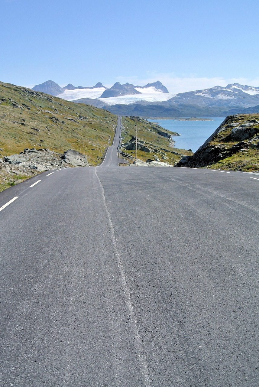
We had already driven the Atlantic Ocean Road, the Trollstigen, and half of Norway’s 18 official scenic routes when a local in Lom told us we were missing the one that matters most. “Drive Sognefjellet,” she said. “Early morning. No traffic. You’ll understand.” She was right. The Sognefjellet mountain road — National Scenic Route 55 through the Jotunheimen mountain massif — turned out to be the most dramatic high-altitude drive we’ve done anywhere in Scandinavia.
This is our honest guide: what the road is actually like, the stops worth making, what surprised us, and the practical stuff nobody puts in the glossy brochures.
The Sognefjellet mountain road (National Scenic Route 55) runs 108 km between Lom and Skjolden through the highest mountain pass in northern Europe, reaching 1,434 m above sea level. It’s typically open from late May to October, takes about 2.5 hours without stops, and is best driven in June or early July when snow still lines the road but conditions are safe. No tolls, no single-track terrors — just genuine high-mountain scenery with easy driving.
What is the Sognefjellet mountain road
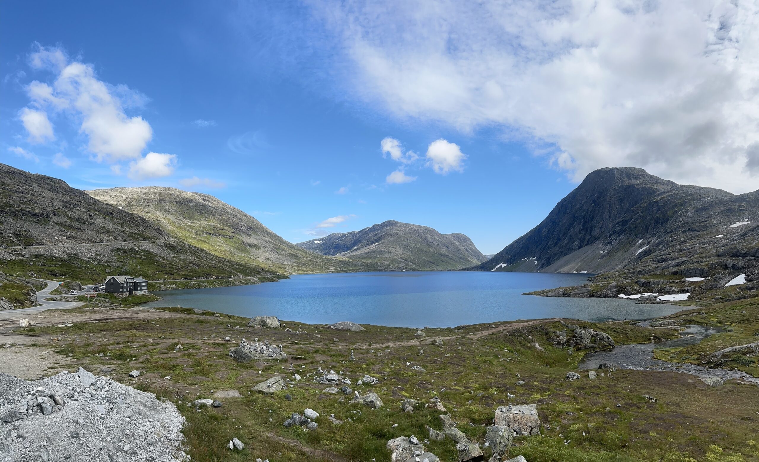
Sognefjellet is the high-altitude section of Norwegian National Route 55, which runs from Lom in the Gudbrandsdalen valley down to Skjolden at the head of the Lustrafjord — itself an arm of the Sognefjord. At its highest point, the road crosses the Sognefjellet plateau at 1,434 metres, making it the highest mountain pass road in northern Europe. It is one of Norway’s 18 officially designated National Scenic Routes.
The geography in plain terms
The route cuts through the heart of Jotunheimen National Park — the “home of the giants” — which contains Norway’s two highest peaks, Galdhøpiggen (2,469 m) and Glittertind (2,465 m). From the road, on a clear day, you can see glaciers, permanent snowfields, and peaks in every direction. The descent to Skjolden puts you right at the Sognefjord, so a single drive takes you from genuine alpine terrain to Norway’s longest fjord in about two hours.
Why it gets less hype than Trollstigen or the Atlantic Road
Both Trollstigen and the Atlantic Ocean Road benefit from extreme visual hooks that photograph dramatically: hairpin bends stacked up a cliff face, bridges arching over crashing sea. Sognefjellet is subtler — it’s the scale and openness that hits you, not a single hero shot. It also sits between Lom and Sognefjord, away from the Bergen-to-Oslo tourist corridor, so fewer international itineraries include it. That’s exactly what makes it good.
When to drive it and how long it takes
The road is closed in winter — usually from late October or November through late April or May, depending on snowfall. The Norwegian Roads Administration (Statens vegvesen) publishes live road status at vegvesen.no, and we checked it obsessively in the days before our drive.
The season windows
- Late May to early June: the road opens, often still heavy snow on the plateau. Dramatic, photogenic, cold. Patches of ice are possible in early morning — drive carefully. This is when the snow walls lining the road are at their highest (sometimes 4–6 metres).
- Mid-June to mid-July: our pick. Snow walls are still present, meadow flowers are starting, the light is extraordinary at midnight sun latitudes. Traffic is manageable.
- Late July to August: peak tourist season. Busier car parks, more campers, but the landscape is fully green and walking trails from the road are ideal.
- September to mid-October: autumn colours, fewer people, risk of early snow on the plateau. Check road status daily.
Driving time and distance
The scenic section from Lom to Skjolden is 108 km. Without stops, the drive takes 2 to 2.5 hours. With proper stops at the main viewpoints — Juvasshytta, Sota Sæter, the Galdhøpiggen trailhead — allow 4 to 5 hours. We took nearly 6 hours and did not regret a minute of it.
The best stops along the Sognefjellet mountain road
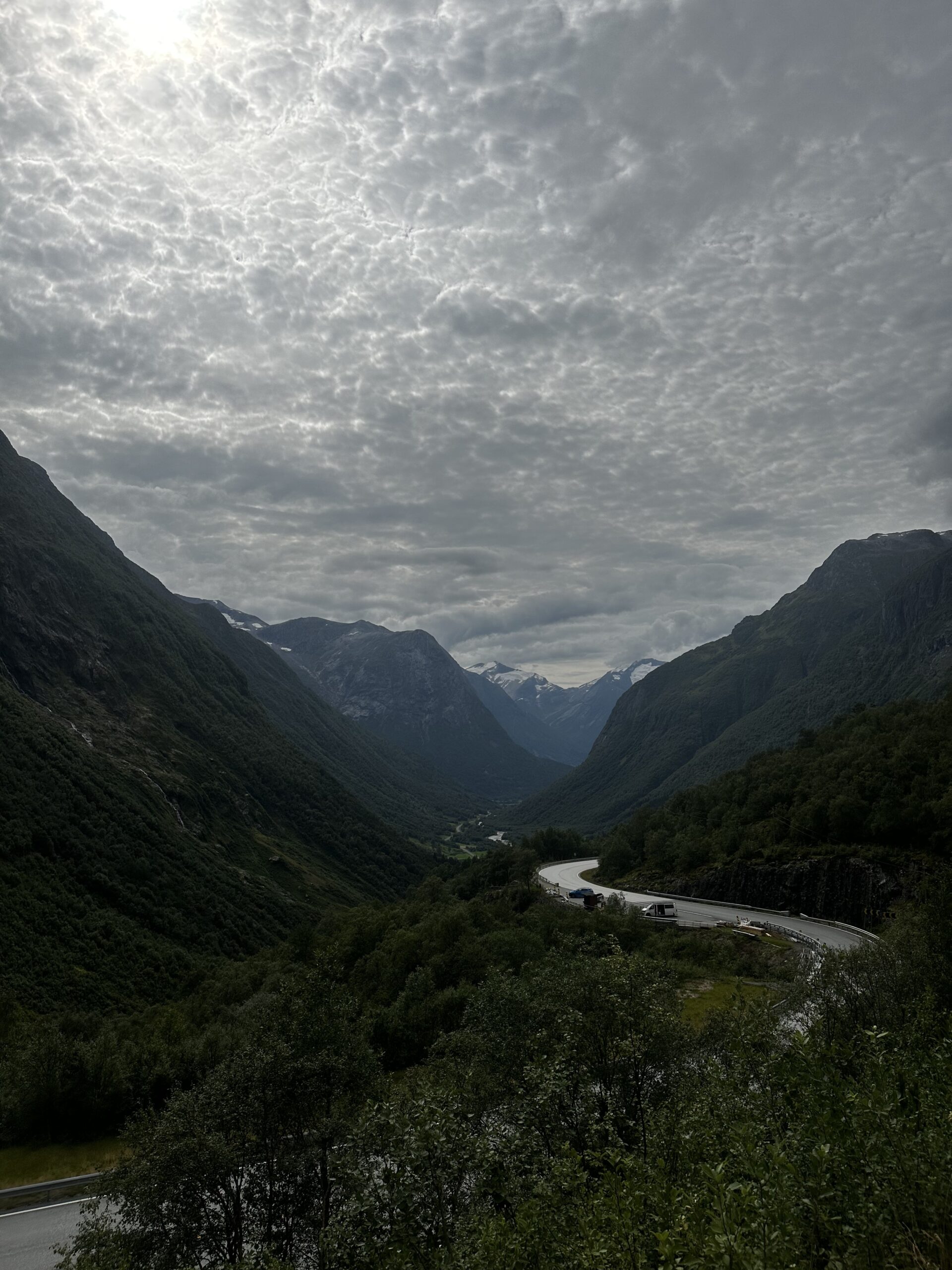
Here are the stops we made, in order from Lom to Skjolden:
- Elveseter (30 km from Lom): a historic hotel and farm complex in a narrow valley before the road climbs. The oldest wooden buildings here date to the 17th century. Good toilet stop and coffee if the café is open.
- Galdhøpiggen / Juvasshytta turn-off (50 km): a marked side road leads to Juvasshytta mountain lodge, the starting point for the glacier-guided ascent of Galdhøpiggen. Even if you don’t hike, drive up to the lodge for the views — it’s extraordinary.
- Sognefjellet plateau (summit area): pull over anywhere near the highest point. There are several small gravel lay-bys. Walk 5 minutes from the road in any direction for total silence and an unobstructed 360-degree mountain panorama.
- Sota Sæter: a traditional mountain farm still in operation in summer. The spot where the road begins its descent toward the fjord — dramatic change of scenery in under 2 km.
- Fortun viewpoint: as the road drops into the valley, pull over here for a first look at the Lustrafjord stretching below. The colour contrast from grey granite to deep blue fjord water is jarring in the best possible way.
- Skjolden (end of route): small village at the head of the Lustrafjord. The ferry from here connects to Gudvangen — if you’re continuing west along the Sognefjord, this is your next move.
Related Planning the full Norway fjord circuit? Read our guide to driving Norway’s fjord country — we cover the best combinations of scenic routes, ferry crossings, and overnight stops.
💡 Our campervan tip: prices for the same van vary a lot between rental brands. We compare Norway campervans across 160+ rental companies on CampervanPlanet — and code HUNGRYTRAVELFAMILY5 takes 5% off.
Practical tips before you drive the Sognefjellet mountain road
Here are the eight things we wish someone had told us before we set out:
The road can close at any time in May and October for snowfall or icing. Check vegvesen.no or the Statens vegvesen app the morning of your drive. Do not rely on a status check from the day before.
The climb from Lom is gradual and gives you the best build-up to the plateau views. The descent to Skjolden is steeper and more dramatic to experience going downward. Both directions work, but Lom-to-Skjolden is the direction we’d repeat.
We left Lom at 6:30 am in June and had the plateau almost completely to ourselves for the first two hours. By 10 am, the campervan traffic had picked up noticeably. Early morning light on the snow peaks is also spectacular.
There is no petrol station on the mountain road. Lom has a station; Skjolden has a small one. Fill up in Lom before you start the ascent.
We drove in late June and it was 24 °C in Lom. On the plateau at 1,400 m the wind was biting and the temperature was 6 °C. A down jacket and windshell are essential even in summer.
Unlike Trollstigen or single-track Highland roads in Scotland, Sognefjellet is a proper two-lane mountain road throughout. Meeting camper vans is straightforward. Driving confidence required: medium.
Norway drive guides & Nordic road-trip notes
We write one honest letter a week from our home in Finnish Lapland — scenic routes, practical costs, and the things we wish we’d known.
How Sognefjellet compares to other Norwegian scenic routes
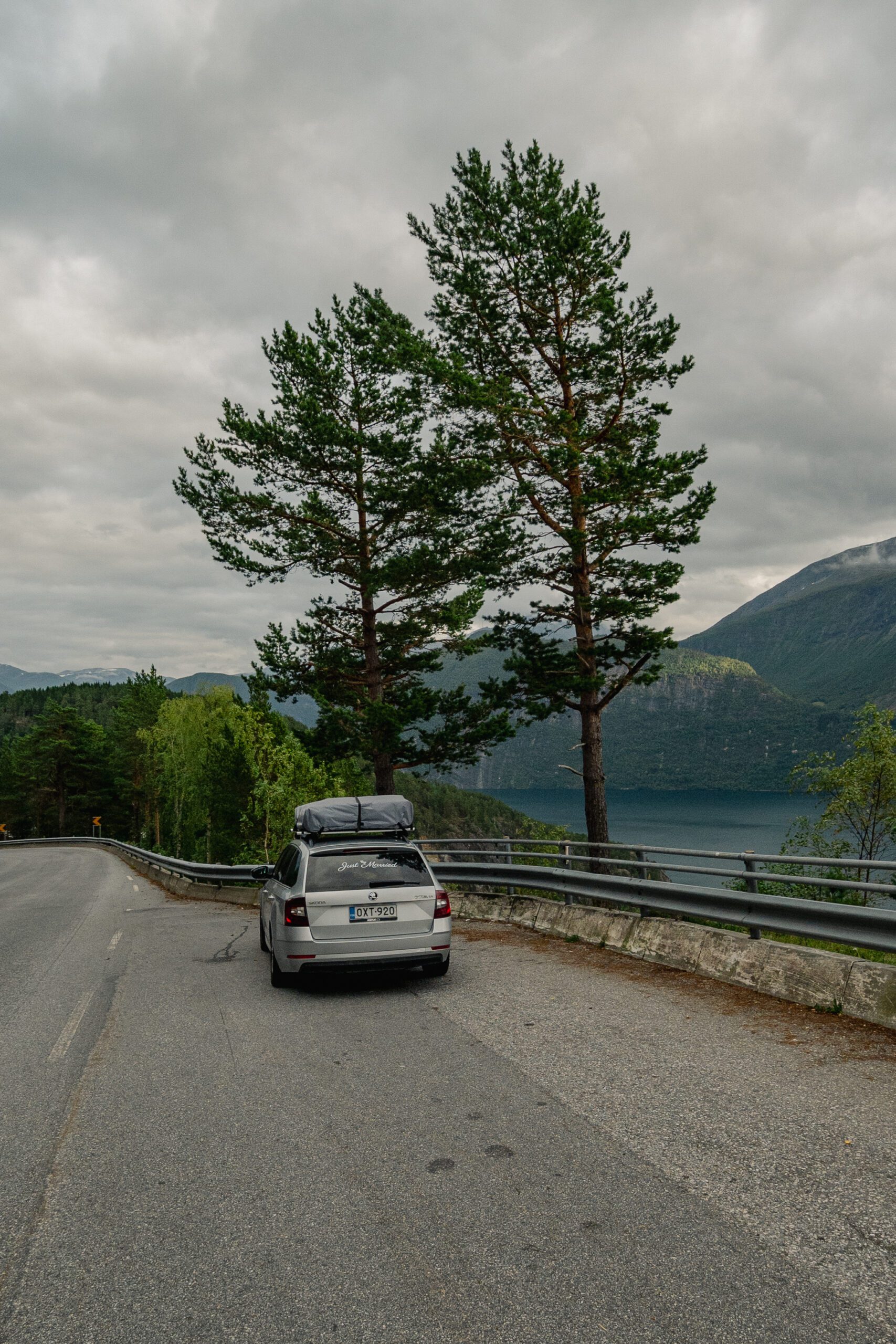
We’ve now driven eleven of Norway’s 18 official scenic routes. Here is where Sognefjellet sits in our honest ranking:
- vs Trollstigen: Trollstigen is more dramatic in a single concentrated way — the hairpins are genuinely impressive. But it’s also very short (a few kilometres of proper mountain driving) and extremely crowded. Sognefjellet rewards you for longer and requires far less patience with tour buses.
- vs the Atlantic Ocean Road: completely different moods. The Atlantic Road is coastal, dramatic, photogenic in a very specific way. Sognefjellet is high-altitude and vast. Both should be on any serious Norway road-trip list — they don’t compete.
- vs Gaularfjellet (Route 13): a hidden gem that fewer people know. Sognefjellet is bigger in scale; Gaularfjellet is more intimate and forested. If you’re based in the Sognefjord area, do both.
- vs Aurlandsfjellet (Snow Road): the Aurlandsfjellet runs roughly parallel and gets more traffic because it’s on the main E16 tourist route. Sognefjellet is wilder and higher. We’d pick Sognefjellet every time if we had to choose one.
- vs Hardangervidda: Hardangervidda is a plateau road and similarly grand in scale but more accessible and more heavily travelled. Sognefjellet feels more remote despite not being technically harder to drive.
More Norway We drove the Hardangervidda too — read our full Hardangervidda driving guide for the comparison in detail.
Mistakes we made on the Sognefjellet mountain road
- Not allowing enough time. We planned 3 hours and used 6. Every pull-out, every short walk, every “just five more minutes looking at the glacier” added up. Budget generously.
- Skipping Juvasshytta. We drove past the Galdhøpiggen turn-off the first time because we thought it was just “another hotel road”. It’s not. The drive up to the lodge at 1,841 m is itself spectacular. We went back the following morning.
- Not checking if the road was open further in advance. We planned the drive a week ahead but only checked the live status the morning of. It turned out there had been a brief closure two days earlier due to snow on the plateau. Check regularly in late May and October.
- Underpacking food. There are no shops or petrol stations on the mountain road. The lodge at Juvasshytta serves food in season, but don’t rely on it. Pack a proper lunch and snacks.
- Missing the descent viewpoint at Fortun. We were so tired by the end that we nearly drove straight into Skjolden without stopping. The viewpoint just above Fortun, where the fjord suddenly appears below, is genuinely one of the best moments of the whole drive. Pull over.
Book your Norway campervan
Compare prices across 160+ campervan and motorhome rental brands, get a free 1GB eSIM with every booking — and 5% off with code HUNGRYTRAVELFAMILY5.
Check prices & availability →Frequently asked questions
Is the Sognefjellet mountain road open year-round?
No. It typically closes in late October or November when heavy snow falls on the plateau and reopens in late April or May, depending on conditions. Check the live road status at vegvesen.no before your trip. The opening date varies by 3–4 weeks from year to year.
Is the Sognefjellet road suitable for campervans?
Yes, the road is a proper two-lane highway throughout. Campervans and motorhomes drive it regularly. The only tight spot is the car park at Juvasshytta if you drive up the side road — that track is narrower, so very large rigs should skip it or check first.
How long does it take to drive Sognefjellet from Lom to Skjolden?
Without stops, about 2 to 2.5 hours. With the main stops (Juvasshytta, the summit area, Sota Sæter, the Fortun viewpoint), budget 4 to 6 hours. We took nearly a full day and did not feel we’d wasted any time.
Can you drive the Sognefjellet road in winter?
No. The road is closed in winter. If you want a similar high-mountain experience in winter, Aurlandsfjellet (the Snow Road) is the closest alternative but it also has a long closure season. Winter driving in this region is via the main valleys and tunnels.
What is the highest point on the Sognefjellet road?
1,434 metres above sea level, making it the highest mountain pass road in northern Europe. The summit area is on the Sognefjellet plateau between the Galdhøpiggen trailhead turn-off and Sota Sæter. You will know when you’re there — it’s unmistakably the top.
Are there tolls on the Sognefjellet mountain road?
No. National Route 55 including the Sognefjellet section has no tolls as of our last drive. This makes it unusually good value among Norway’s scenic experiences — most of the best views here cost nothing beyond fuel and time.
A final word from Rovaniemi
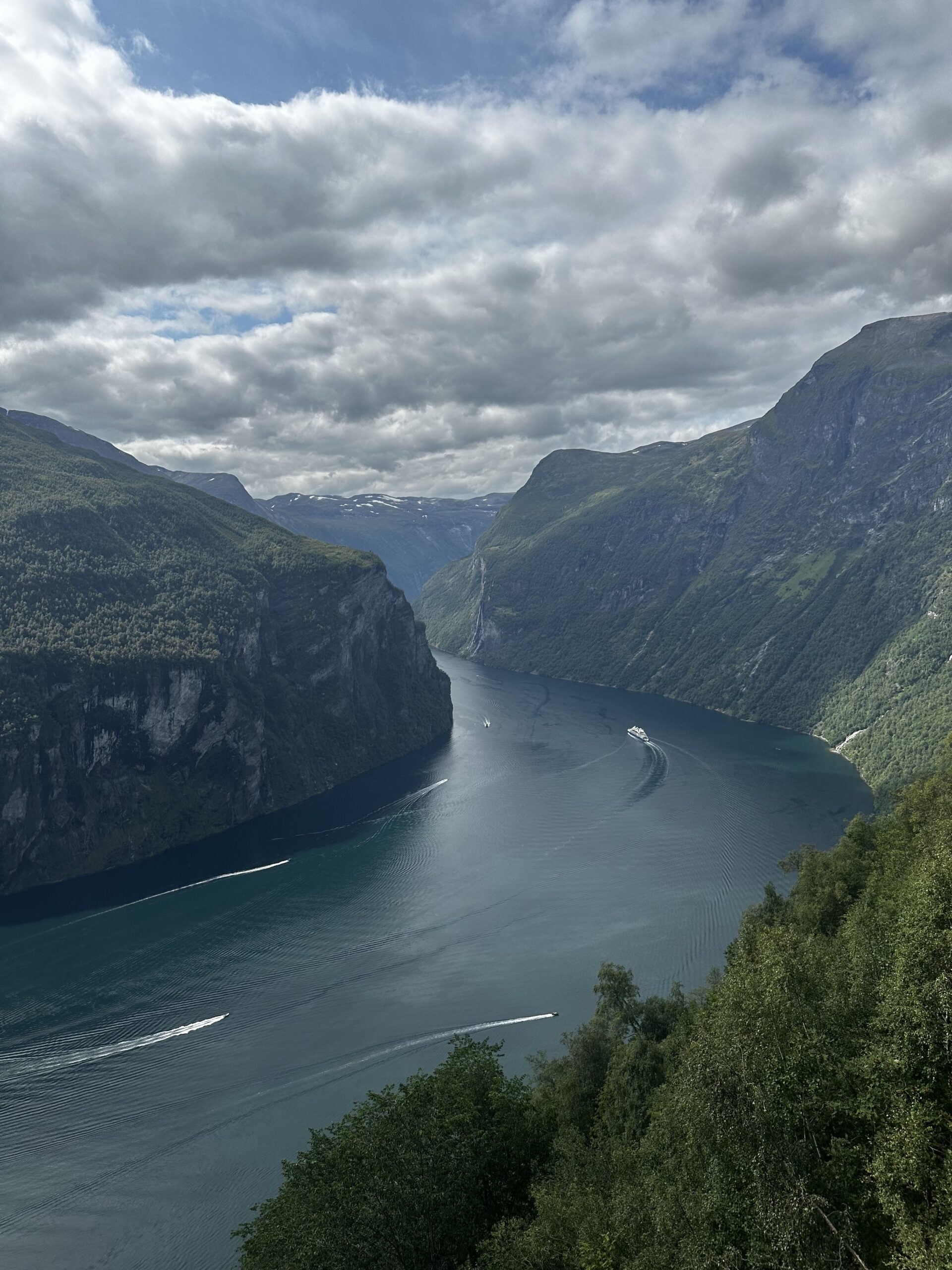
We drive a lot of mountain roads. Living in Rovaniemi, we’ve spent years crossing the Finnish Arctic on empty highways, looping through Norwegian Lapland, and working our way down through the fjord country in summers we could steal from work. After all of that, Sognefjellet is still the road we’d recommend to someone who asks for one Norway drive that isn’t on every listicle.
It doesn’t have a single jaw-dropping moment to put in a photo. It has two solid hours of jaw-dropping — the kind that builds slowly, that makes you quiet in the car, that you keep thinking about days later when you’re back at your desk. That’s a different thing, and in our experience, it’s the better one.
Leave Lom before the campervans wake up. Bring a sandwich. Stop more than you think you need to.
Joona & Alla
A Finnish-Ukrainian couple living in Rovaniemi, Finland. Joona is a marketing professional in Lapland tourism; Alla is an AI Engineer. Together we’ve visited 25 countries and share honest, locally-grounded travel writing from our home in the Arctic.
Read our full story →