Traveling Remote Islands by Car — What We’ve Learned Across the North Atlantic
From the Faroe Islands to Iceland’s highland tracks and the outer edges of Norway, we’ve driven remote islands in all conditions. Here’s what actually matters before you turn the key.
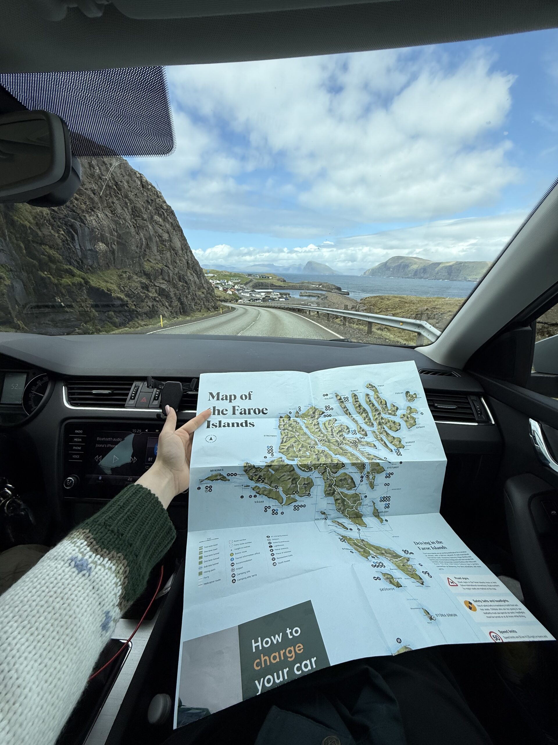
We drove our first remote island by car almost by accident. We had a ferry to the Faroe Islands booked, a small rental with summer tyres, and a very rough plan sketched in a notebook. Three days later we had coaxed that car through a single-track tunnel under a fjord, across a gravel mountain pass, and back again in horizontal rain. We were hooked.
Since then we’ve driven islands across the North Atlantic — Iceland’s F-roads, the outer islands of Norway’s Lofoten chain, Estonia’s island of Saaremaa, and several others. Remote island car travel has its own logic, its own rhythm, and its own list of things that will catch you if you’re not prepared. This is our attempt to write that list down.
Traveling remote islands by car is one of the most rewarding ways to explore — but it demands more planning than mainland driving. Research ferry timetables early, understand road classifications before you rent, pack for the worst weather forecast you can imagine, and always carry more fuel than you think you need. Do those four things and the rest sorts itself out on the road.
- Choosing the right car for remote island roads
- Ferry logistics: booking, timing, and the gaps nobody tells you about
- Road conditions quick-reference by destination
- Fuel, connectivity, and supplies — the practical checklist
- Weather and when to stop driving
- The remote island mistakes we made
- FAQ
- A final word from Rovaniemi
Choosing the right car for remote island roads
The single biggest variable on a remote island road trip is the vehicle. Most people book whatever is cheapest at the airport, then discover that the road to the viewpoint they want is gravel, that F-roads in Iceland legally require a 4WD, or that the Faroe Islands’ mountain passes get icy in June.
What the rental categories actually mean
Car classification varies by country, but in the North Atlantic context there are really three tiers you need to understand:
- Small city car (2WD, low clearance): fine for Iceland’s Ring Road and paved Faroe Islands routes. Not legal on Iceland F-roads. Will bottom out on rough Faroese gravel tracks. Adequate for Norway’s paved island roads (Lofoten included).
- Medium SUV (2WD or AWD, decent clearance): the sweet spot for most remote island trips. Handles most gravel, copes with standing water on poorly drained tracks, and usually fits in standard ferry lanes. AWD adds security on loose gravel — it’s not the same as 4WD on true mountain terrain.
- 4WD (true differential lock): mandatory for Iceland’s interior highland F-roads. Worth it in the Faroe Islands if you plan to drive the older mountain passes. Overkill for Norway’s Lofoten, which is well-paved throughout.
Specific gotchas we’ve encountered
- In Iceland, insurance does not cover damage from river crossings regardless of your car class — and some F-roads require them.
- In the Faroe Islands, several older mountain tunnels (before the new subsea ones) have priority signs where you yield to oncoming traffic in passing bays. It feels counterintuitive if you’ve never done it before.
- Norway’s Lofoten has virtually no unpaved roads on the main route, but the side tracks to hidden beaches are often unpaved and steep.
Ferry logistics: booking, timing, and the gaps nobody tells you about
Remote islands are, by definition, reached by ferry or plane. For car travel, that almost always means a ferry — and ferry logistics are where most island road trips go wrong. We’ve missed departures, waited out cancelled crossings, and once spent an extra night on an island we hadn’t planned for because a storm closed the sailing. That night turned out to be one of our favorites, so we don’t entirely regret it, but you should still plan better than we did.
Booking far enough in advance
- Iceland (Smyril Line): book weeks or months ahead in peak summer. Car spaces sell out before passenger spaces. Don’t wait until you’ve decided on flights.
- Faroe Islands (same Smyril Line): the same sailing. If you’re doing Iceland + Faroes in one loop, book the entire route at once.
- Norway island ferries: most short crossings (Lofoten, Vesterålen, Senja) don’t need advance booking — you queue. Long routes (Bodø–Lofoten, Bergen–Kirkenes Hurtigruten) should be booked ahead for summer.
- Estonia’s island ferries (to Saaremaa, Hiiumaa): the causeway to Saaremaa now exists, but ferries to smaller islands like Hiiumaa need advance booking in July and August.
The “gap day” you should budget
Any remote island sailing can be cancelled or delayed by weather, especially in autumn and winter. We budget one extra day of flexibility at the end of any island trip that requires a specific ferry to continue the journey. Missing that crossing with a flight to catch behind it is a very stressful afternoon.
Road conditions quick-reference by destination
Based on our own driving across these islands, here’s an honest quick-reference for the destinations we’ve actually visited. This is the list we’d want before we went.
- Faroe Islands — paved main roads: the primary ring road between islands (where connected by bridge or subsea tunnel) is sealed and well-maintained. Shoulder drops off sharply. Speed limit 80 km/h on open road, 50 in villages.
- Faroe Islands — gravel and mountain tracks: several older routes to viewpoints are unsealed. Perfectly drivable in a standard car in dry weather; slippery in rain. Some have no guard rails.
- Faroe Islands — paid tunnels: three subsea tunnels now connect Eysturoy and Streymoy. Each has a toll. Pay via the Faroe Islands toll app or a toll kiosk at the ferry terminal. Do not just drive through — unpaid tolls are charged at premium to rental companies.
- Iceland — Ring Road (Route 1): almost entirely paved. Some eastern sections are gravel. A standard 2WD car is fine for the entire ring.
- Iceland — F-roads: mountain roads marked “F” on maps. 4WD mandatory by law. Closed until late June most years. Always check road.is before entering.
- Lofoten, Norway: the E10 is fully paved. Side roads vary — some to beaches are unpaved and occasionally steep. No special vehicle needed.
- Saaremaa, Estonia: main roads are paved; smaller island roads are gravel. No elevation to speak of. Standard car is fine.
Stories from the road, once a month
No algorithms, no sponsored content. Just what we actually drove, learned, and ate that month.
Fuel, connectivity, and supplies — the practical checklist
On the mainland, running low on fuel is an inconvenience. On a remote island in the North Atlantic, it can be a long, windy wait for someone to drive out with a jerry can. These are the practical things we check before any island leg.
- Fuel range: note the distance between petrol stations on your planned route before you leave the main settlement. In the Faroes and Iceland, some island circuits have no stations for 60–100 km. Fill up every time you pass a station, not just when the gauge drops.
- Opening hours: many petrol stations on remote islands are unmanned and card-operated. This is fine — but ensure your card works without a chip-and-PIN issue. Some older automated pumps reject foreign cards.
- Mobile data: coverage is surprisingly good in Iceland and Norway. The Faroe Islands have excellent 4G across inhabited areas but essentially nothing on the uninhabited outer cliffs. Download offline maps (Google Maps or Maps.me) for each island before you lose signal.
- Cash: most islands in the Nordic countries are cashless in practice. Bring a backup card, not cash.
- Food and water: on islands like Mykines (Faroes) or Iceland’s Westfjords settlements, the only café may close at 4 pm. Carry a day’s worth of food and a filled water bottle whenever you’re heading somewhere with no settlement marked on the map.
- Spare tyre: rental cars often have a run-flat or a foam kit rather than a full spare. Know what’s in your boot before you leave the rental lot. On some Faroese gravel tracks, a proper spare would be the smarter option.
- Warm layers, even in summer: we drove the Faroe Islands in July in full rain gear and were grateful for it. Island microclimates change in twenty minutes.
- Headlamps and a power bank: if you’re parking at a trailhead and walking, you may come back after dark. Islands don’t always have street lighting on rural roads.
Weather and when to stop driving
We’ve driven through storms we probably shouldn’t have. We’ve also parked up for three hours waiting for a squall to pass and been rewarded with an afternoon of calm and extraordinary light. Experience has taught us to read the signals earlier.
- Wind is the real hazard, not rain. In the Faroes and Iceland, sustained winds above 20 m/s (72 km/h) make driving a high vehicle or a campervan genuinely dangerous on exposed roads. Check Vedur.is (Iceland) or Faroese Meteorological Office forecasts every morning.
- The “no guard rail” test. Before driving an unfamiliar gravel road, get out and walk the first 100 metres. If there are no guard rails and a cliff drop and you can feel the wind on your face, park the car and walk from there.
- Don’t drive into fog on mountain passes. What looks passable at the bottom of a mountain pass can become whiteout at the top. Pull over, wait, or turn back. No viewpoint is worth a roll-off.
- Road closures in Iceland are enforced. The road.is website shows live closures. F-roads that are marked closed are closed — rangers do check, and driving a closed road voids your rental insurance entirely.
- Build in buffer time. On a remote island circuit, add 30–40% more time than the map estimate suggests. You will stop more than you expect. You will encounter a sheep herd on the road. You will pull over for a photograph that turns into twenty minutes.
The remote island mistakes we made
These are real errors from our own trips, listed plainly so you don’t repeat them.
- Booking a 2WD and not checking road status. On our first Iceland trip, we nearly drove to the F-road start before realising our rental was not legal on it. We turned back and spent the afternoon on the paved track instead — which was still beautiful — but we’d planned five hours in the highlands. Check the map category before booking the car.
- Not downloading offline maps in advance. The Faroe Islands tunnel system is confusing on its own. Without data, we got turned around twice. Offline maps take five minutes to download and save a lot of reversing.
- Underestimating tunnel tolls in the Faroes. We drove the Vágatunnilin three times in one day and paid each time. The cost adds up. Get the app before your trip, not after.
- Trusting a weather window that wasn’t ready. We drove a Faroese mountain pass in a brief patch of sunshine that lasted exactly eight minutes. We were stuck on the gravel in horizontal rain for forty of them. Now we wait for at least two-hour clear windows before committing to exposed routes.
- Not eating before leaving the last settlement. In Iceland’s Westfjords, we left Ísafjörður with half a breakfast and no snacks for an eight-hour circuit. The one café on the route was closed. We were very grumpy by the end.
- Driving at dusk without checking sunset time. In summer at these latitudes, “dusk” is deceptive — it can still look light at 11 pm but the road colours and contrast flatten in a way that makes gravel tracks harder to read. Know when actual darkness (or the closest equivalent) falls and factor it in.
Frequently asked questions
Do I need a 4WD to drive in the Faroe Islands?
Not for the main paved roads and subsea tunnels — a standard car handles those fine. If you want to drive older gravel mountain passes or remote tracks to clifftop viewpoints, an SUV with decent clearance gives you more confidence. True 4WD is not legally required anywhere in the Faroe Islands, unlike Iceland’s F-roads.
Can I bring my own car to the Faroe Islands or Iceland by ferry?
Yes. The Smyril Line (which connects Denmark, the Faroe Islands, and Iceland) accepts personal vehicles. Book your car space well in advance for summer crossings — they fill up before passenger tickets do. This is often how longer-stay overlanders travel the region.
How long does it take to drive around the Faroe Islands?
The main inhabited islands you can drive to are connected by tunnels and bridges. If you drove continuously without stops, you could circuit the main ring in roughly 3–4 hours. In practice, a relaxed exploration of the main islands takes 3–5 days. The outer islands like Mykines and Svinoy require additional ferries.
Is it safe to drive F-roads alone in Iceland?
Iceland’s mountain interior F-roads involve river crossings, unstable gravel, and rapidly changing weather. Driving alone increases risk because help is far away. If you go solo, file your itinerary with a contact at home, use the 112.is app which shares your GPS position, and stick to routes you’ve researched in detail. Many travelers prefer guided tours or convoy groups for highland F-road travel.
What’s the best island in the world to drive for scenery?
We’re biased, but the Faroe Islands are hard to beat. The combination of sea cliffs, grass-roofed villages, subsea tunnels, and a road network that genuinely rewards a slow pace makes it unlike anywhere else we’ve driven. Iceland’s Snæfellsnes Peninsula is a close second. Lofoten in Norway is extraordinary but the single main road limits variation.
What happens if I miss my island ferry?
On most Norwegian short crossings, you join the next queue — crossings are frequent enough that it’s rarely more than an hour’s wait. On longer or rarer routes (Smyril Line, Westfjords ferries), missing your sailing can mean a day’s delay. Always arrive at the ferry port 30–40 minutes before the listed departure if you have a car. Car lanes board before walk-on passengers.
A final word from Rovaniemi
We plan a lot of our driving from a kitchen table in Arctic Finland, with a map and a notebook and usually a cup of coffee going cold. Remote island road trips are the ones we plan most carefully and enjoy most completely — not despite the uncertainty, but because of it.
There’s a particular feeling you get when you’ve driven to the far edge of a remote island and the road simply ends at a cliff and the sea. No more infrastructure, no more options, just the sound of the wind and the knowledge that you got yourself here under your own steam. That feeling doesn’t get old.
The preparation is worth it. The flexibility is worth it. The extra day you build in for a storm that may or may not come is almost always worth it — either you spend it watching weather move across the sea, or you spend it driving roads you didn’t plan on and finding the best of your whole trip hidden down an unmarked track.
Drive the remote islands. Just go in well-fed, with a full tank and a downloaded map.
Joona & Alla
A Finnish-Ukrainian couple living on the Arctic Circle. Joona leads marketing for a Lapland tourism company; Alla is an AI engineer and content creator. Together we’ve visited 21 countries — including the Faroe Islands, Iceland, Norway, Estonia, and much of northern Europe — and share honest, locally-grounded travel writing from our home in Finnish Lapland.
Read our full story →