The Faroe Islands by Car: Everything You Need to Know
We drove every island we could reach in the Faroes — including the underwater tunnel nobody warns you about. Here is what actually matters before you pick up the keys.
We have driven across 25 countries from our base in Rovaniemi, Finland, and very few road trips have stayed with us the way the Faroe Islands did. Eighteen islands, about 50,000 people, and a road network that feels like someone ran tarmac across the bottom of the Atlantic Ocean just to see what would happen. The views are extraordinary. The tunnels are genuinely strange. The one-lane roads require a patience you didn’t know you had.
If you are planning to drive the Faroe Islands, this is the guide we wished we had before we went.
Yes, you can — and should — drive the Faroe Islands yourself. Renting a car is the only practical way to see more than Tórshavn. The roads are challenging but manageable for any confident driver: expect single-lane gravel tracks, short mountain tunnels, and one subsea roundabout. The main islands are connected by tunnels and ferries, and most highlights are within two hours of the capital.
What Faroese roads are actually like
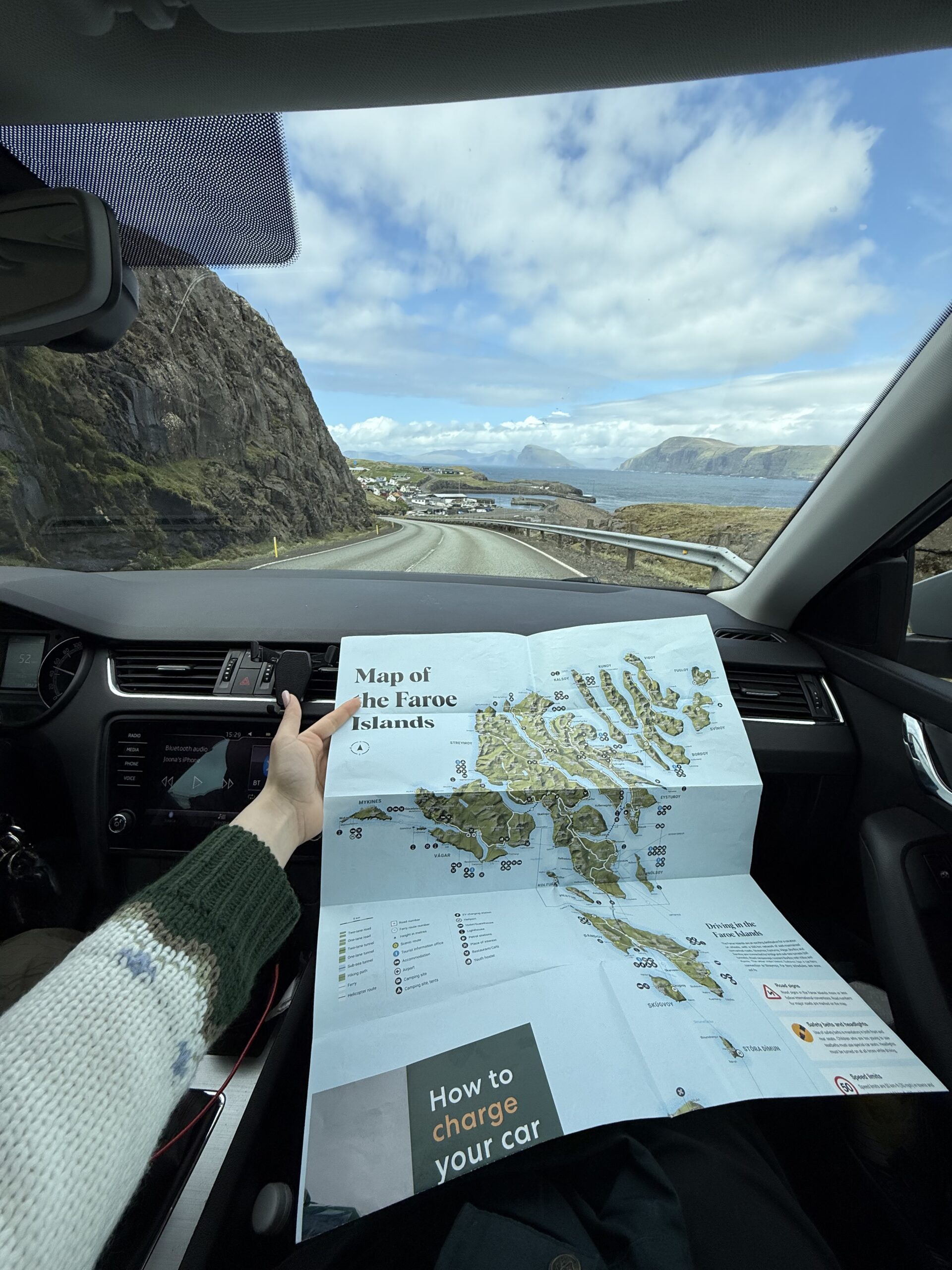
The first thing to understand is that “roads” in the Faroe Islands covers an enormous range. Between the main towns you will find well-maintained two-lane tarmac that is perfectly easy to drive. Venture off those arteries and the picture changes quickly.
The three road types you will encounter
- Main paved roads (Route 10, 40, 50, etc.): wide enough for two vehicles, good surfaces, clear signage. These connect the major settlements and are what most of your driving will be.
- Single-lane country roads: one lane with passing places roughly every 100–200 metres. You pull into the nearest lay-by when you meet oncoming traffic. Locals are extremely patient and will flash their lights to signal it is safe to pass. This is where you see the best scenery.
- Gravel tracks (mountain roads): unmaintained paths that climb to viewpoints and remote villages. No barriers in many places. Mandatory for reaching places like Saksun, Gásadalur before its tunnel, and the northern tip of Enniberg cliff. Low clearance rentals will struggle.
Weather changes everything. We drove a section above Funningur in bright sunshine and returned the same road two hours later in a fog so thick we could see perhaps 15 metres ahead. The Faroes switch between four seasons in an afternoon — this is not hyperbole, it is Tuesday.
Speed limits and road conditions
- General speed limit is 80 km/h on open roads and 50 km/h through villages.
- In practice, single-lane roads force you to 30–40 km/h anyway — overtaking is irrelevant and the scenery demands you slow down.
- Sheep are everywhere and have no road sense whatsoever. Brake early and often.
- Mountain-road surfaces can be wet even on sunny days because of waterfall spray and morning mist. Slow down on any descent.
How to rent a car in the Faroe Islands
Renting a car here is straightforward but there are a few points the booking confirmation will not tell you.
Where to rent
- Vágar Airport: all major rental desks (Avis, Budget, Europcar, and local companies like Faroe Car Rental) are at arrivals. This is the easiest option. Pre-book in peak summer months — the fleet is not large.
- Tórshavn harbour and centre: several local operators. More flexibility if you are arriving by ferry from Denmark.
- Recommended vehicle type: a standard mid-size automatic SUV or crossover handles everything comfortably. Avoid tiny hatchbacks for the mountain gravel tracks unless you are sticking to tarmac. We drove a Ford Puma and it was borderline on the rougher sections.
Practical rental notes
- Fuel: there are petrol stations in Tórshavn, Klaksvík, Runavík, and at Vágar. Fill up whenever you see a station — some northern stretches have nothing for 40–50 km.
- Most roads have no streetlights. If you are driving after dark (which barely happens in summer) your headlights are doing all the work.
- GPS coverage is good but not infallible on mountain tracks. Download an offline map (Maps.me or OsmAnd) before leaving the airport.
- Some rental companies restrict vehicles from specific unmaintained tracks — check your agreement before attempting Enniberg or the rougher Mykines approach roads.
5 Days in the Faroe Islands: The Itinerary We’d Repeat Tomorrow
Our full day-by-day breakdown of what to see, where to sleep, and how to pace a first Faroe Islands trip.
Read the itinerary →Key routes and drives to plan
Think of Faroese driving in three tiers: the main island chain, the northern islands, and the outliers that need a ferry. Here are the eight routes and stops worth building a driving plan around.
The eight essential driving stops
Allow 2.5 hours including stops. The last 3 km to Saksun is a single-lane track through a valley — slow down, not because it is dangerous but because it is beautiful. The lagoon and turf-roofed church reward every kilometre.
Cross the bridge (now free since 2020) onto Eysturoy and drive north. The village of Gjógv sits at the end of a natural gorge — remarkable. The climb back out on the gravel road offers views that justify every scratch on your bumper.
The northernmost village in the Faroes. The road narrows to a single lane under dramatic cliffs and the drive takes about 25 minutes from Klaksvík. One of the few places where the Atlantic is visible on both sides simultaneously.
One of the highest sea cliffs in the world, 754 metres. The gravel track is steep and the parking area tiny. Leave the big SUV at the bottom if you are not confident; the walk from the lower parking is 20 minutes and worth it.
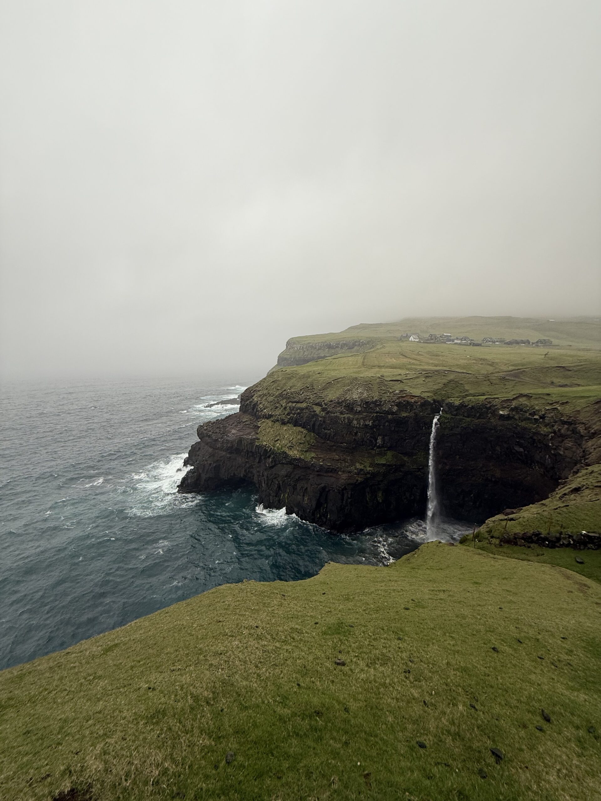
The new tunnel opened in 2006 and cut Gásadalur off from its previous isolation. Drive through, park in the village, and walk to the Múlafossur waterfall viewpoint. Allow 30 minutes from Sørvágur.
Lake Sørvágsvatn (also called Leitisvatn) appears to float above the ocean from the right angle. The walk from the road is about 4 km return but you can drive close. One of the most photographed landscapes in the Faroes.
A 20-minute ferry from Gamlarætt gets you to Sandoy — far quieter than the main islands. One good paved loop road, almost no other tourists in summer. Good for a half-day away from the crowds.
The southernmost island and two hours by ferry from Tórshavn. Worth it for a full-day circuit if you have five days or more. Almost completely tourist-free.
Tunnel and ferry tips
No guide to driving the Faroe Islands is complete without a proper section on the tunnels. There are currently four subsea tunnels connecting islands, and one of them contains a roundabout 180 metres below sea level. This is as strange as it sounds.
The four subsea tunnels
- Vágatunnilin (Vágar – Streymoy): 4.9 km, single lane with passing bays, opened 2002. The original subsea tunnel — narrow and atmospheric.
- Norðoyatunnilin (Streymoy – Eysturoy): 6.3 km twin-tube tunnel, toll (around DKK 100 per car). This is the main connection to the northern islands.
- Eysturoyartunnilin: opened 2020, this two-lane 11.2 km tunnel connects Tórshavn to Runavík and contains the world’s only subsea roundabout. Toll applies. It cut driving time between the two main hubs from 40 minutes to 16.
- Sandoyartunnilin: opened 2023, connects Streymoy to Sandoy. Replaces the ferry for most journeys. Toll applies.
Ferry lines worth knowing
- Gamlarætt – Sandur (Sandoy): now supplemented by the tunnel but ferries still run — book via Strandfaraskip Landsins (SSL).
- Tórshavn – Tvøroyri (Suðuroy): 2-hour crossing, runs twice daily. Book online or at the terminal — car space can sell out in summer.
- Sørvágur – Mykines: access to the puffin island. Only pedestrians; leave the car in Sørvágur. Subject to weather cancellation — book early and have a backup day.
Nordic travel, honest and unhurried
We send one newsletter per week: things we noticed, routes we drove, and ideas we think are worth your time. No spam, no sponsored fluff.
Subscribe free →Rules, tolls, and parking
The 10 things to know before you start the engine
- Drive on the right. The Faroe Islands use right-hand traffic, same as mainland Europe and Scandinavia. Not obvious if you are coming from the UK or Ireland.
- Headlights on at all times, day and night, by law.
- Speed limit in villages is strictly 50 km/h. Police presence is low but fines are high.
- Tunnel tolls are cashless. Your rental car should have an account or tag — confirm this before you drive the Eysturoyartunnilin.
- No right-of-way on single-lane roads. The person closest to a passing place should reverse to it. Local drivers are surprisingly relaxed about this.
- Parking in Tórshavn centre costs DKK 10–15 per hour via meter or the EasyParking app. Outside the capital it is free everywhere.
- Mountain roads may be closed in winter and sometimes in summer after heavy rain — check vegur.fo for real-time closures.
- Phone signal is good on main roads but disappears entirely on many mountain tracks. Download offline maps before you leave the airport.
- Fuel in the Faroes is roughly 20–30% more expensive than mainland Europe. Budget accordingly.
- Sheep have legal right of way on all roads. This is not a joke; they are treated as livestock and their owners are legally not liable for collisions. Slow down.

Mistakes we made driving the Faroe Islands
We have done this drive and collected a list of things we would change if we went again tomorrow.
- Underestimating how long everything takes. Every map says 25 minutes. Every drive is 50 minutes because you stop constantly. Budget double the navigation time.
- Not checking vegur.fo in the morning. We spent half a day trying to reach a viewpoint on a road that was closed after overnight rain. The website shows live closures in English.
- Booking the smallest rental car to save money. A tiny hatchback on the Enniberg gravel track is an uncomfortable experience. The extra DKK 150 per day for an SUV is worth every krone.
- Not pre-booking the Mykines ferry. We arrived in Sørvágur on a Thursday afternoon in July to find all crossings for the next two days full. Book weeks ahead in peak summer.
- Ignoring the weather window. We drove the Saksun valley in fog and rain and it was still beautiful. But we nearly skipped the Gjógv drive because of clouds, and in the final hour it cleared into the most dramatic light we saw all trip. The Faroes reward patience.
- Not filling up in Klaksvík before heading north. There is no petrol station north of Klaksvík on the eastern islands. We coasted back on fumes.
How to See Puffins in the Faroe Islands (Mykines Guide)
The Mykines ferry, the cliffside walk, and everything to know about timing your puffin visit right.
Read the Mykines guide →Frequently asked questions
Can I drive to all the islands in the Faroe Islands?
Not by road alone. The main island chain — Streymoy, Eysturoy, Norðoyar, Vágar, and now Sandoy — is connected by tunnels and bridges. Suðuroy requires a 2-hour ferry from Tórshavn. Mykines is foot-passenger only. The remote islands (Hestur, Koltur, Stóra Dímun, Lítla Dímun) have no car access at all.
Do I need an international driving licence to drive in the Faroe Islands?
Travellers holding EU/EEA, UK, US, Canadian, or Australian licences can drive with their national licence. Most other nationalities are also accepted, but confirm with your rental company. The Faroe Islands are not an EU member state despite using the Danish krone.
How long does it take to drive around the main islands?
The main paved circuit — Tórshavn, Eysturoy, Norðoyar, and back via the western islands — is technically drivable in six to seven hours. In practice, with stops at viewpoints, villages, and waterfalls, budget two to three full days for the highlights.
Is driving in the Faroe Islands suitable for beginners?
The main roads are fine for any driver. The single-lane mountain tracks require more confidence — not technical skill, but the patience to reverse 50 metres to let a van past without panicking. If you are comfortable with rural driving in Ireland or Scotland, you will be fine.
What happens if it is foggy? Should I still drive?
Fog is extremely common and rarely stops anyone. Reduce speed, use your headlights, and avoid mountain tracks above the cloud line if you cannot see the road. The main inter-island roads are well marked and perfectly drivable in fog. Some of our favourite views arrived when a fog patch suddenly cleared.
Is there a road tax or entrance fee for the Faroe Islands?
There is no country-wide road tax or visitor entrance fee. Tunnel tolls apply on the Norðoyatunnilin, Eysturoyartunnilin, and Sandoyartunnilin — typically DKK 80–110 per tunnel for a private car. Your rental company will usually handle these automatically and charge your card on return.

A final word from Rovaniemi
Living in Lapland gives you a certain baseline for dramatic landscapes. We are not easily impressed by big empty sky or roads that disappear into fog. The Faroe Islands still managed to stop us in our tracks — repeatedly, unexpectedly, on roads we had not expected to be beautiful.
Faroese driving is not like driving in most of Europe. It rewards slowness. The instinct to hurry from highlight to highlight will work against you. The best moment of our trip happened on a nondescript road near Funningur when a fog bank rolled off a hillside and revealed a village below that we had not known was there. We had not planned to stop. We stayed for two hours.
Rent something with decent clearance, download vegur.fo to your bookmarks, fill up at every opportunity, and give yourself more days than you think you need. The islands are small but they expand when you drive them slowly.
— Joona & Alla, writing from Rovaniemi, Finland
Joona & Alla
A Finnish-Ukrainian couple living in Rovaniemi, Finland. Joona is Head of Marketing at Stay Lapland; Alla is an AI content engineer. Together they have driven, ferried, and hiked through 25 countries and counting. This site is their honest record of what worked, what didn’t, and what they’d do again tomorrow.
Read our full story →