The Finnish Archipelago Trail: A 4-Day Driving Guide
We live in Finnish Lapland, but the Finnish archipelago trail is the road trip we keep coming back to — granite islands, ferry crossings, and a coastline that genuinely has no equal in summer.
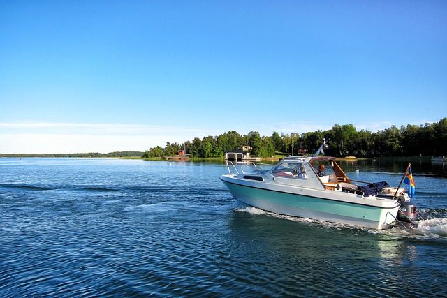
We’ve driven the Finnish Archipelago Trail twice now — once in late June with the midnight sun barely setting, once in early August just as the coastal light turned amber and the fishing villages emptied out. Both times we came home from Rovaniemi promising ourselves we’d go back sooner. The Finnish archipelago trail (in Finnish, Saaristotie) is a signposted scenic route that winds through the world’s largest archipelago by island count — somewhere between 40,000 and 80,000 islands depending on how you count the rocks — connecting the southwest Finnish coast between Turku and Pargas by road and free ferry crossings.
This guide is the one we wished we’d had on our first drive: what to actually do each day, which ferries run when, and the small things that turn a pleasant road trip into one of the best drives in Northern Europe.
The Finnish Archipelago Trail is a 4-day scenic driving route along the southwest coast of Finland, linking islands by free state ferries. The best time is mid-June to mid-August. Base yourself in Turku and drive roughly 250–300 km total, including ferry hops. No booking needed for the ferries — they’re free and run year-round.
What the Finnish Archipelago Trail actually is
The Archipelago Trail is Finland’s most famous scenic driving route, and it genuinely earns that title. It runs from Turku in the north, loops through the outer islands, and curves back east toward Hanko and Salo. The full loop is around 250 km of actual driving, but the route itself — with ferries — feels much longer because so much of it is water.
The basics
- Start/finish point: Turku (Finland’s former capital, easy to reach by train from Helsinki in under 2 hours).
- Total driving distance: roughly 250–300 km depending on how many side roads you explore.
- Ferry crossings: 5–7 free state-operated ferry hops, some running every 30 minutes, some every 60–90 minutes. No booking, no payment — drive on, drive off.
- Best season: mid-June through mid-August for swimming, sunshine, and open cafés. Late May and September are quieter but some island businesses close.
- Car required: yes. You can cycle the route (it’s a classic bike route too), but for a 4-day drive with stops you need a car.
Why the archipelago is different from anything else in Finland
Finland is famous for its lakes, but the archipelago coastline feels completely different from the lake district up north. The light here is maritime, softer and more golden in midsummer. The islands are low, granite, scattered with wind-bent pines and red fishing cottages. It’s quieter than the Norwegian fjords, more intimate than the Swedish coast, and almost completely untouched by mass tourism outside of a few known spots near Turku.
How to plan your 4-day route
We’ve structured this as four genuine travel days, each with a different character. You could compress it into 3 days if you push, but you’d miss the whole point — the archipelago rewards slowing down.
Day 1 — Turku to Pargas (Parainen)
Start in Turku. Spend the morning in the Old Great Square market and walk the Aura riverside before you drive. Cross the long Airisto bridge to Pargas, the gateway to the outer archipelago. Pargas is a Swedish-speaking town (about 55% of the population here speaks Swedish as their first language — you’ll notice the bilingual signs immediately). Pick up supplies at the Pargas market hall — local archipelago bread (saaristolaisleipä) is a must — and find your cottage or guesthouse for the night. Evening: sit by the water and watch the light go golden until midnight.
Day 2 — Pargas to Nagu (Naantali) via Korpo ferry
This is the best day on the route. Drive through Pargas, catch the free ferry from Lillmalo to Korpo, then continue to Nagu. The Nagu guest harbour is one of the prettiest in Finland — wooden sailboats, a tiny church, a cluster of cafés with outdoor terraces. Swim off the rocks before lunch. In the afternoon, drive to the Korpo archipelago nature reserve if you want pure wilderness. Night in Nagu or Korpo.
Day 3 — Nagu to Houtskar and Inio
The outer islands get wilder and quieter here. Houtskar is accessible by a longer ferry hop and feels genuinely remote — fewer tourists, more reindeer. (No, not Lapland reindeer — but you’ll spot deer.) The road quality drops but the scenery improves. If you have time, push to Åselô or Inio for the farthest, quietest islands on the trail. Sleep on the outer islands if you can find a cottage — it’s worth it.
Day 4 — Return loop via Kimitooön and Salo
Loop back east through Kimitooön (Kimito Island), which has a different character — more farmland, more mainland feel, but still beautiful. Stop at Sagalunds Open-Air Museum if history is your thing, then rejoin the main highway via Salo and return to Turku (or drive straight on toward Helsinki).
Related reading Planning a broader Finland summer trip? Our guide to the best things to do in Finland in summer covers the whole country, from Lapland down to the coast.
Quick-reference: ferries, logistics, and key stops
Here is the practical reference block for driving the route. The ferry schedules are from Finnish Transport Infrastructure Agency (Traficom) — check finferries.fi for live updates, as summer timetables differ from winter.
Key ferry crossings on the trail
The Airisto bridge covers the first crossing — no ferry needed here, just drive across. The bridge itself is worth a stop for the view over the outer bay.
One of the most scenic crossings. Runs roughly every 60 minutes in summer. Drive time: 20 minutes on the water. Free. Capacity around 50 cars — arrive 15 minutes early on weekends in July.
The Nagu guest harbour has its own small ferry connection. Check local timetables — the Houtskar crossing runs less frequently (every 90 minutes in peak season).
The most remote crossing. Small boat, every 2 hours in summer. This one can fill up — if you’re taking a caravan, call ahead to Finferries.
Pargas / Parainen: market hall, archipelago bread, Airisto view. Nagu: guest harbour, cafés, swimming rocks, church. Korpo: nature reserve, quiet roads, proper solitude. Houtskar: remote outer island, wildlife, minimal crowds. Kimitooön: Sagalunds museum, farmland, return route east.
Fuel: fill up in Pargas before heading to the outer islands — stations get sparse. Cash: a few outer-island stalls are cash-only. Mobile data: coverage is good on main islands, patchy on Houtskar and Åselô. Accommodation: book cottages at least 4–6 weeks ahead for July — the best ones go fast.
Get our best travel tips in your inbox
Monthly stories from Rovaniemi — Arctic tips, packing lists, and the places we keep coming back to.