The Four-Country Alpine Crossing: A New 78km Trail for 2026
Europe’s newest long-distance route links Austria, Germany, Switzerland, and Liechtenstein in a single continuous trail — and we’ve been tracking it from our desk in Rovaniemi with serious envy.
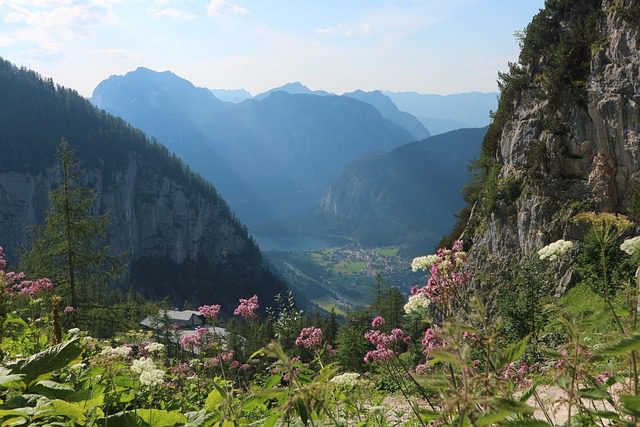
We plan our trips from a kitchen table in Finnish Lapland, 2,500 km from the nearest mountain range. That distance hasn’t stopped us from following the launch of the Four-Country Alpine Crossing with a kind of restless excitement. When a brand-new 78-kilometre trail opened in 2026 linking four countries across the Alps — Austria, Germany, Switzerland, and Liechtenstein — we added it to the list immediately.
This guide covers everything we know about the trail: the route, the logistics, what to expect on the ground, and why this particular walk is resonating with the growing crowd of travelers looking for a cooler, quieter summer in Europe.
The Four-Country Alpine Crossing is a new 78-kilometre hiking trail launched in 2026 that links Austria, Germany, Switzerland, and Liechtenstein across the Alps. It takes roughly 5–7 days to complete, is best walked June to September, and requires moderate fitness but no technical climbing skills. It’s one of the most exciting new long-distance routes in Europe.
What is the Four-Country Alpine Crossing?
The Four-Country Alpine Crossing is a newly established long-distance hiking route that threads through the meeting point of four Central European nations. The trail connects the Austrian state of Vorarlberg, the German region of Bavaria, the Swiss canton of St. Gallen, and the tiny principality of Liechtenstein — all within a single continuous route of approximately 78 kilometres.
What makes it different from existing Alpine paths is the deliberate emphasis on crossing borders on foot. You physically walk from one country to the next, with signage in multiple languages, and pass through villages that have functioned as crossroads for centuries. For travelers who have done the Alps before and want something with a narrative thread, this route provides one.
Why 2026 is the right year to do it
The trail opened to walkers in 2026 with coordinated infrastructure across all four nations — unified signage, mapped hut networks, and a shared digital trail passport that stamps each country border crossing. It’s new enough that the path still feels uncrowded compared to classics like the Tour du Mont Blanc or the Via Alpina.
Who it’s for
The trail is classified as moderately challenging. There are ascents and descents of several hundred metres each day, and some sections cross high passes above 1,800 m. But unlike technical Alpine routes, it does not require ropes, crampons, or mountaineering experience. If you’ve walked multi-day routes in Scandinavia, Ireland, or Portugal, you have the base fitness for this.
The route in detail: day by day
Most hikers complete the crossing in five to seven days, depending on daily mileage and how much time they want in each village. The route runs roughly east-to-west, starting in Austria and finishing in Switzerland, though westbound is equally viable.
A suggested day-by-day structure
- Day 1 (Austria — Bregenz to Eichenberg): The trail begins at Lake Constance, where Austria, Germany, and Switzerland converge at a single point. From Bregenz, the first section climbs into the hills of Vorarlberg, offering views across the lake that stretch to the Swiss shore. About 14 km, 600 m ascent.
- Day 2 (Germany — Lindau region to border villages): The route dips briefly into the Bavarian corner of Lake Constance, passing through small lakeside settlements before turning south again. This is a shorter day by design — roughly 12 km — giving walkers time to appreciate the German section without rushing through it.
- Day 3 (Liechtenstein — Vaduz and the Rhine valley): Crossing into Liechtenstein is one of the highlights. The principality is tiny — you can walk across its full width in a day — but Vaduz castle on the hill above the trail is genuinely striking. The Rhine valley floor is flat and fast; the ascent to the Swiss border comes at the day’s end. About 16 km.
- Day 4 (Switzerland — Appenzell region): The Swiss section passes through the Appenzell Innerrhoden, one of the most traditional cantons in the country. The rolling hills and painted farmhouses feel different from the drama of the Bernese Oberland — quieter, greener, and surprisingly intimate. About 14 km.
- Day 5–6 (Switzerland — St. Gallen area to final destination): The trail finishes in the St. Gallen canton, descending to a valley town with train connections in all directions. Walkers with extra time can extend into the Toggenburg valley for a bonus day. About 22 km across two days.
Related reading If you’re planning a multi-country trip around this trail, our guide to sleeper trains in Europe 2026 covers the overnight options from Munich and Zurich that work well as trail bookends.
Quick-reference trail facts
Everything you need at a glance
Total distance: approximately 78 kilometres. Countries crossed: Austria, Germany, Liechtenstein, Switzerland. Recommended duration: 5–7 days. Best season: June to September. Trail marking: unified blue-and-white signage across all four countries.
Moderate. Total elevation gain: approximately 2,800 m. Highest point: around 1,850 m. No technical climbing required. Suitable for experienced day-hikers and beginners with multi-day experience.
A mix of mountain huts (Hütten/refuges) and guesthouses in valley villages. Most huts require advance reservation in July and August. Budget: roughly €50–80 per person per night including dinner and breakfast in huts.
Start at Bregenz, Austria (direct trains from Zurich, Munich, and Innsbruck). Finish near St. Gallen, Switzerland (trains to Zurich in 70 minutes). Bregenz is the more convenient starting point for most international travelers.
A digital trail passport is available via the official trail app. Each border crossing has a stamp point. Completing all four countries earns a completion certificate — a small but satisfying detail that makes the multi-country nature of the route tangible.
You’ll need both euros (Austria, Germany) and Swiss francs (Switzerland, Liechtenstein). Card payments are widely accepted, but carrying some francs is wise for smaller mountain huts.
Get our best travel tips in your inbox
Monthly stories from Rovaniemi — Arctic tips, packing lists, and the places we keep coming back to.