The Best Norway Coastal Drives Beyond the Atlantic Ocean Road
We’ve driven Norway’s coast from end to end. These are the routes the guidebooks skip — and the ones we’d take again before we touched the Atlantic Ocean Road a second time.
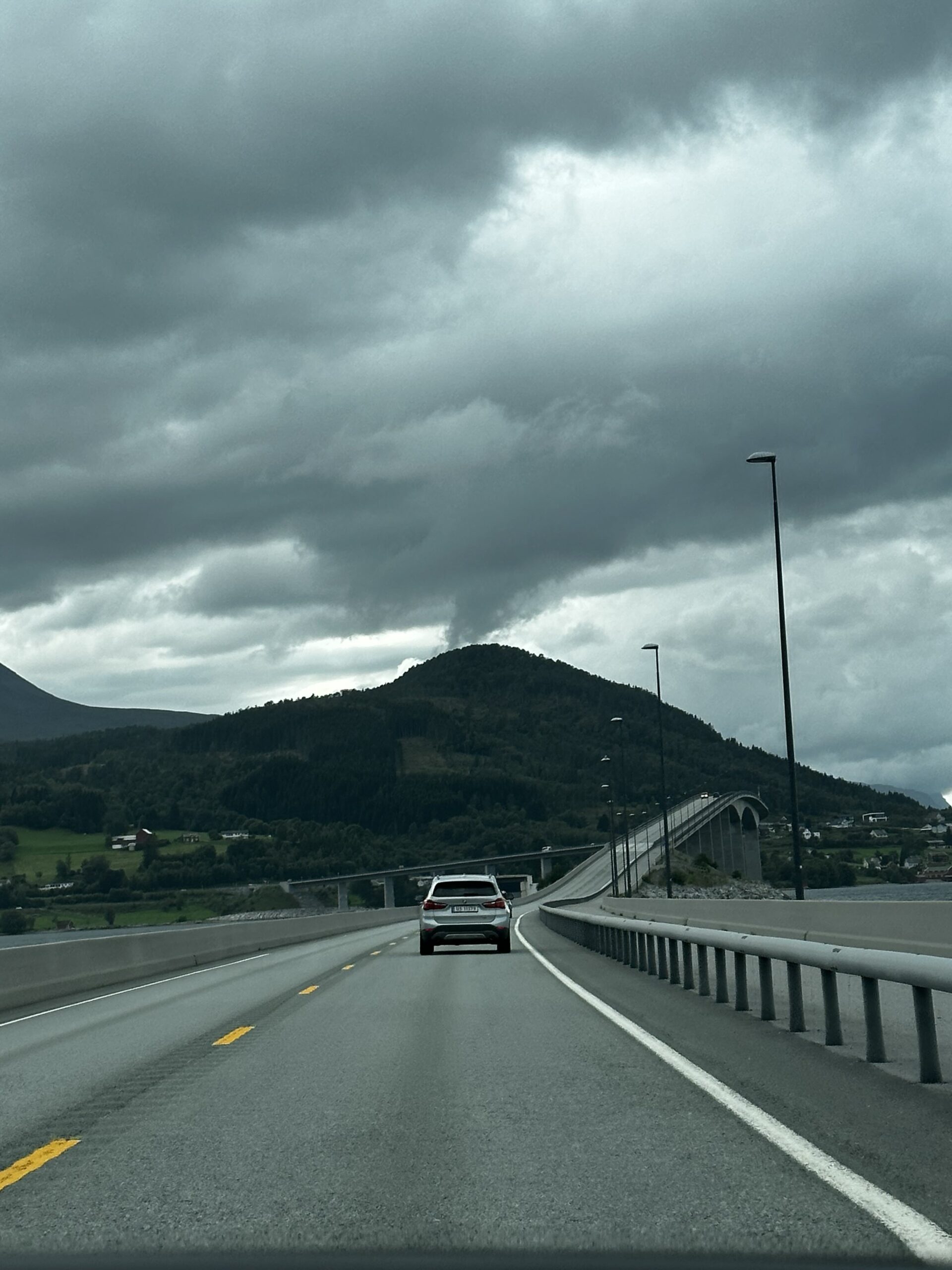
The Atlantic Ocean Road gets all the Instagram attention, and yes — it earns it. But Norway has hundreds of kilometres of coastal driving that rival it in beauty and beat it on solitude. We’ve driven across Norway more times than we can count from our base in Rovaniemi, which puts us just a few hours from the Finnish-Norwegian border, and we’ve made a habit of exploring the roads that don’t show up in every travel roundup.
These are the Norway coastal drives we’d actually recommend — the ones that had us pulling over every twenty minutes, the ones where we shared the road with reindeer more often than other tourists, and the ones that still give us that full-chest feeling when we look at the photos.
Norway’s best coastal drives extend far beyond the Atlantic Ocean Road. Routes like the Helgeland Coastal Route (Rv17), Senja Island, and the Jæren Coastal Road offer equally spectacular scenery with a fraction of the crowds. The ideal strategy: combine two or three shorter coastal stretches into a loop, drive in the evening for midnight-sun light in summer, and keep your tank full — petrol stations can be 60+ km apart on the remote sections.
Why look beyond the Atlantic Ocean Road
The Atlantic Ocean Road — Atlanterhavsveien — is eight kilometres long. Norway’s coastline is over 25,000 kilometres, including fjords and islands. That context alone should tell you something. We first drove Atlanterhavsveien on a grey October morning, and it was genuinely beautiful. We also counted seventeen other cars parked at the main viewpoint at the same time, on a Tuesday, in the shoulder season.
What makes a coastal drive worth the detour
When we scout a coastal drive for our own trips — or for the travel brands we work with through our content studio — we look for three things: viewpoint variety (islands, skerries, open sea, fjord arms), infrastructure reality (where can you sleep, where can you eat, where is the nearest petrol station), and the solitude factor. The best Norway coastal drives we’ve found score high on all three, and most of them are not on the standard tourist circuit.
- Rv17 (Kystriksveien): 650 km from Steinkjer to Bodø, taking in ferry crossings, island bridges, and open Helgeland coast.
- Senja Island (Troms county): a 90-minute drive from Tromsø with scenery that looks like a compressed version of the Lofoten.
- Jæren Coastal Route: flat, wind-swept, and dramatic in a completely different way — sandy beaches and North Sea swell south of Stavanger.
- Andøya: Norway’s most northerly island accessible by road, with whale safari access, white sand beaches, and almost zero visitors outside July.
Our honest take on the Atlantic Ocean Road
We’re not saying skip it. If you’re in the Møre og Romsdal area, drive it — especially in stormy weather when the waves crash over the causeways. It’s a legitimate icon. What we are saying is: don’t let it be the only coastal driving you do in Norway. The country is far too large and too varied for that.
The Helgeland Coastal Route (Rv17)
The Helgeland Coastal Route, officially marked as Rv17, is the most underrated long-distance coastal drive in Norway. At 650 kilometres, it connects Steinkjer in the south to Bodø in the north, crossing the Arctic Circle somewhere in the middle. We drove the central section — from Sandnessjøen north past the Seven Sisters mountain range to Mo i Rana — and we talk about it more than almost any other drive we’ve done in Scandinavia.
What to expect on Rv17
The road combines everything that makes Norwegian coastal driving special: tight two-lane sections that hug the shoreline, open bridges over tidal inlets, mandatory ferry crossings that give you a forced pause to stand on deck and just look, and the Seven Sisters ridge (De Syv Søstre) rising straight out of the sea across the Vefsnfjord. In summer, the light at 11 pm is honey-golden and the road is nearly empty.
- Distance: 650 km (Steinkjer to Bodø). You don’t have to drive all of it — the best sections are between Sandnessjøen and Mo i Rana.
- Ferry crossings: plan for 4–6 crossings depending on your route. They run regularly, cost €15–25 per car, and add roughly 45–90 minutes per crossing to your schedule.
- Arctic Circle crossing: the road crosses the Arctic Circle at roughly the Saltstraumen area, where you’ll also find the world’s strongest tidal current — worth a stop.
- Best base towns: Sandnessjøen (good hotels, airport) and Mo i Rana (train connections south, glacier day trips east).
- Petrol stations: don’t rely on phone signal. Fill up every chance you get, especially north of Sandnessjøen.
The Seven Sisters ridge rising from the sea was the moment we understood why Norwegians say the Helgeland coast is the most beautiful part of Norway. We’d stopped arguing by the time we reached Sandnessjøen.
Senja: Norway’s hidden island drive
Senja is Norway’s second-largest island and one of its most spectacularly scenic. It’s also — for reasons we haven’t fully worked out — far less visited than Lofoten, despite being arguably more dramatic. You reach it via the E10 bridge from the E6 south of Tromsø, and from there a single road loops the entire island.
The Senja Scenic Route
The official scenic route on Senja runs along the western coast, where the mountains rise almost vertically from the sea and the fishing villages sit in tiny bays below dramatic peaks. The most photographed spot is Tungeneset viewpoint — a wooden platform over the water with a view of the Okshornan peaks. It looks exactly like the Lofoten, except there were four other cars when we were there instead of forty.
- Loop distance: about 200 km for the full island circuit. Comfortably driven in a day, or slow-travelled over two.
- Drive time from Tromsø: 90 minutes to the island bridge. Senja makes an easy two-night side trip from a Tromsø base.
- Key stops: Tungeneset viewpoint, Husøy fishing village (connected to the main island by causeway), Berg museum (local fisheries history), Hamn i Senja hotel (if budget allows — it’s a converted trading post).
- Road conditions: mostly paved, some single-track sections on the west coast with passing places. Take your time.
- Summer midnight sun: Senja is above the Arctic Circle, so in June and July the sun never sets. The west-coast road in the early hours of the morning — 1 or 2 am — is otherworldly.
We parked the car at Tungeneset at midnight in late June with the sun still fully above the horizon. There was one other couple there. On a normal afternoon in Lofoten, that same view would have had fifty people.
More drives, real itineraries, and the roads we’d skip
Our newsletter goes out twice a month with the planning detail that doesn’t fit in a blog post.
💡 Our campervan tip: prices for the same van vary a lot between rental brands. We compare Norway campervans across 160+ rental companies on CampervanPlanet — and code HUNGRYTRAVELFAMILY5 takes 5% off.
A quick-reference list of 8 more Norway coastal drives
Beyond Rv17 and Senja, Norway has routes that reward drivers who go looking. These eight are worth knowing before you plan your itinerary — each one covers a completely different type of coastal scenery.
- Jæren Coastal Route (south of Stavanger): completely flat, windswept North Sea beaches, lighthouses, and Iron Age burial mounds. Opposite of what you expect from Norway. Drive it in one direction for the full sweep from Stavanger to Egersund.
- Andøya, Vesterålen: white sand beaches at 69°N. It sounds impossible, and it looks impossible too. Connect via Sortland and take the bridge across from Hinnøya. Whale safaris run from Andenes from May to September.
- Ørstafjord and Hjørundfjord area (Sunnmøre Alps): south of Ålesund, the road into Hjørundfjord is one of the narrowest and most spectacular fjord drives in Norway. A 40-km dead-end road that dead-ends somewhere beautiful.
- Varanger Peninsula (Eastern Finnmark): bleak, treeless Arctic coast with sea eagles overhead and Russia visible across the fjord. The most raw coastal driving in mainland Norway. Drive E75 from Varangerbotn to Vardø for full effect.
- Hardanger Fjord scenic road (Rv7 via Eidfjord): the fjord itself is famous; the road section between Odda and Eidfjord along the south shore is less known. Apple orchards, waterfalls, and the fjord arm below — summer is peak season for the blossoms.
- Namdalen coast (Trøndelag): north of Trondheim before you hit Rv17, the Namdalen coastline on Fv17 is largely ignored because it lacks a catchy name. Quiet fishing villages, island panoramas, and a ferry to Vikna archipelago.
- Leka Island: an hour by ferry from Gutvik or Horn in Namdalen, Leka is a 67 km² island with prehistoric rock art, a striking pink-and-grey geology, and roads with no traffic. A full loop takes two hours and feels like a private discovery.
- Lyngen Peninsula (north of Tromsø): the Lyngen Alps drop straight into the Lyngenfjord. The drive along the western shore from Lyngseidet south is a continuous postcard — snow-capped peaks, farmsteads, clear fjord water. Less than two hours from Tromsø.
Practical tips for Norway coastal driving
Driving Norway’s coast is not difficult, but there are practical realities that catch first-time visitors off guard. After dozens of drives from our Rovaniemi base, these are the things we actually tell people before they go.
- Ferry timetables are not optional reading. Many coastal routes include mandatory ferry crossings. Download the Ferjedrift or Frammr app before you leave, check the timetable the night before, and always know what happens if you miss the last ferry. Some crossings run once every two hours; missing one changes your day.
- Petrol is expensive and stations are sparse. Norway has some of the highest fuel prices in Europe. Fill up in larger towns, not at the tiny unmanned stations on remote stretches where prices are even higher. When in doubt, fill half a tank every chance you get.
- Toll roads and AutoPASS. Norway’s road network includes automatic toll points. Rent a car with a toll transponder included (most rental companies offer this). If you drive without one, your rental company will charge you the tolls plus an admin fee weeks after your trip. Keep receipts.
- Single-track roads with passing places. The narrow sections on Senja, Hjørundfjord, and Andøya require confidence reversing into passing places. The etiquette: the car heading uphill or away from the nearest passing place reverses. Slow down, be patient, make eye contact.
- Weather can close roads. Even in summer, storm fronts come in fast on exposed coastal sections. Check Yr.no (Norwegian meteorological service) for a 48-hour forecast before committing to a tight itinerary on open coastal roads.
- Overnight parking is generally fine. Norway’s allemannsretten (Everyman’s Right) allows overnight parking in nature outside private property. Most coastal viewpoints with a pull-off are fair game for a campervan night. This is the main reason Norwegian coastal driving by campervan is so good.
The routes we’d compare head to head
We get asked constantly: how does Senja compare to Lofoten? How does Rv17 compare to the Atlantic Ocean Road? Here’s our honest comparison based on what we actually experienced on each.
- Senja vs Lofoten: Lofoten is more dramatic in its peaks-meet-sea photography. Senja is more peaceful and, we’d argue, just as beautiful. If you’ve done Lofoten, Senja is the obvious next move. If you haven’t done either, do Senja first and use Lofoten as the headline destination — it earns its reputation.
- Rv17 (Helgeland) vs Atlantic Ocean Road: completely different in character. The Atlantic Ocean Road is a 30-minute highlight reel; Rv17 is a two-day story. Rv17 wins on total experience and sheer variety. The Atlantic Ocean Road wins on spectacle per metre.
- Jæren vs typical Norwegian coast: Jæren makes no sense for Norway. Flat beaches, dunes, North Sea wind — it could be Denmark. That’s exactly why it’s worth it. If you want contrast after driving fjords for a week, Jæren delivers it.
- Lyngen vs Senja: both are north of Tromsø and both are spectacular. Lyngen is better for hiking (Alps access, glacier tours). Senja is better for a pure road-trip loop. Combine them if you have five days based in Tromsø.
- Varanger vs everything else: Varanger is for a specific traveller — someone who wants genuine remoteness, birding, and a landscape that is extreme rather than pretty. Not a comparison to other coastal drives; a category of its own.
Mistakes we made on Norwegian coastal roads
- Trying to drive Rv17 in three days. We budgeted three days for the Helgeland section and ran out of time before Bodø. The route has too many stop-worthy places to rush. Give it five days minimum, or drive a 200 km section and do it properly.
- Missing the last ferry to Leka. We arrived at the Gutvik ferry dock twelve minutes after the last sailing of the day. There was no accommodation in Gutvik. We slept in the car. It was fine — but it was avoidable.
- Driving Senja during midday light in August. We came back a second time at midnight. The first visit was pretty. The second was extraordinary. If you’re in Norway in summer, rearrange your sleep schedule for midnight-sun coastal driving. It’s worth the exhaustion.
- Underestimating single-track stress. The western coastal loop on Senja has long single-track sections. On our first drive we were nervous about reversing for oncoming traffic. By hour three, we were fine. Give yourself a settling-in period before driving the most remote sections.
- Not checking the weather before the Varanger drive. The Varanger Peninsula in a horizontal rain is not spectacular — it’s just wet and miserable. We wasted a full driving day because we hadn’t checked the 48-hour forecast. Yr.no is free; use it.
- Assuming petrol stations were open after 8 pm. Many unmanned rural stations on coastal routes accept card payment 24 hours, but several we relied on in Namdalen were card-reader broken or only accepted Norwegian bank cards. Carry cash as backup.
Book your Norway campervan
Compare prices across 160+ campervan and motorhome rental brands, get a free 1GB eSIM with every booking — and 5% off with code HUNGRYTRAVELFAMILY5.
Check prices & availability →Frequently asked questions
Is the Helgeland Coastal Route (Rv17) driveable in a regular car?
Yes. The entire Rv17 is paved and accessible in a standard two-wheel-drive car in summer. Some minor side roads and viewpoint pull-offs can be loose gravel, but you don’t need a 4WD. The ferry crossings accept all vehicle types, including campervans and motorcycles.
How long does it take to drive around Senja?
The full island loop is about 200 km and takes four to five hours of pure driving. In practice, you’ll stop far more than you expect — plan a full day or, better, overnight on the island. There are a handful of small hotels and cabin rentals, and wild camping by campervan is legal at most coastal pull-offs.
Can you drive Norway’s coastal routes without a car rental and use public transport instead?
Some routes — particularly Rv17 — are served by the Hurtigruten coastal express and local buses. However, the detail and freedom that make these drives special are almost entirely lost without a car. Public transport will get you to the main towns; it won’t get you to the viewpoints that make the routes worth doing.
What is the best time of year to drive Norway’s coastal routes?
Mid-June to early August gives the midnight sun, maximum daylight, and generally stable weather. September is our second pick — fewer tourists, golden light, and the first autumn colours in the mountains. Avoid May on the northern routes (Senja, Varanger, Andøya) as snow can still close minor roads and the landscape hasn’t greened up yet.
Are Norway’s coastal drives suitable for campervans?
Most of them, yes. Rv17 is the most campervan-friendly, with regular campsites, service points, and legal wild camping spots. Senja’s western loop has some narrow passages that require confidence in a larger vehicle, but most campervans manage fine if the driver takes it slowly. Avoid the very narrow fjord-arm dead-ends (like Hjørundfjord) in anything larger than a medium van.
How do Norway coastal drives compare to Iceland’s Ring Road?
Iceland’s Ring Road is more famous and more infrastructurally complete — petrol, accommodation, and services are easier to predict. Norway’s coastal routes are more varied in character, more dramatic in places (the Sunnmøre Alps, the Helgeland coast), and more isolated in others. For pure road-trip freedom, we’d take Norway. For ease of planning and iconic scenery per kilometre, Iceland has the edge.
We live at the top of Finland, which means Norway’s coast is — genuinely — our backyard road-trip territory. Every long weekend between October and May, we ask ourselves: drive west into Norway, or go somewhere else? The answer is almost always Norway. The coastal roads specifically, because no matter how many times we’ve done them, there’s always a section we haven’t seen, a ferry we haven’t taken, a viewpoint that wasn’t in any article we read.
The Atlantic Ocean Road is worth your time. So is the rest of Norway’s coast. Next time you’re planning a Norwegian road trip, add one route from this list to your itinerary — not instead of the famous one, but alongside it. You’ll be glad you did.
Joona & Alla
A Finnish-Ukrainian couple living in Rovaniemi, Finland. Joona is a marketing professional in Lapland tourism; Alla is an AI Engineer. Together we’ve visited 25 countries and share honest, locally-grounded travel writing from our home in the Arctic.
Read our full story →